2010-08-27 49 10
| Fri 27 Aug 2010 in Bamberg: 49.7009501, 10.0454791 geohashing.info google osm bing/os kml crox |
Location
Today's location is in an orchard near Sommerhausen, not far from Würzburg.
Country: Germany; state: Bayern (Bavaria, EU:DE:BY); administrative region: Unterfranken; district: Würzburg rural district
Weather: At first sunny with clouds, then rainy with distant thunder.
Expedition
Danatar
After coming home from work I took my bike, loaded the geohashing gear (prepared the day before) and started out. With only two stops (I met a friend on the street and I bought new bike repair stuff) I cycled along the Main to Sommerhausen. I was full of energy and made good progress. In Sommerhausen I had to climb a steep slope, when I heard the first distant thunder. I continued towards the hashpoint. On the last half kilometre, the track was a bridle way and cycling was difficult. At the last corner before the hashpoint I left the car and continued on foot. A light rain started.
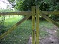
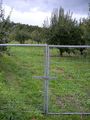
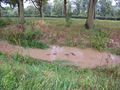
About 15 metres from the hashpoint I was stopped by a fence. I walked along the fence, circulating the hashpoint. There were 5 gates to the orchard, 4 of which were closed and locked. The fifth was closed but not locked and could be opened easily. Although there was no sign forbidding access, the fence and the locked gates were a clear signal that strangers were not meant to enter, so I stayed outside.
I returned to my bike and started towards home. The rain got a little stronger, but it was still not more than a little inconvenient. The thunder was much nearer by then. When I cycled past Eibelstadt, the rain was even stronger, so I stopped under a small bridge and waited for a while. After about 15 minutes the rain lessened and I went home.
I cycled ~35.5 km.
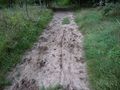
bridle path, guess which track is mine

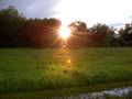
dark clouds
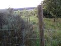
fence near the hashpoint
closed and locked gate
closed but not locked gate

Coordinates not reached :-(
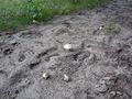
mushrooms on the bridle path
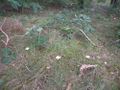
mushrooms

waiting for the rain to stop
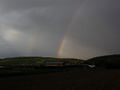
double rainbow
ducks floating down a creek
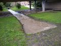
a creek blocked by a too-small pipe under the road


