2011-03-17 49 8
| Thu 17 Mar 2011 in 49,8: 49.7345653, 8.8628694 geohashing.info google osm bing/os kml crox |
Contents
[hide]Location
On an orchard close to Fränkisch-Crumbach
Participants
Expedition
As usual, I started my expedition at the main station of Heidelberg. In Weinheim, I changed to the old secondary line Weschnitztalbahn. The engine driver of the diesel locomotive had to use the horn for every small road the train crossed, so he was almost constantly honking.
I left at the terminus, Fürth, and started cycling from there. The weather was pretty lousy, especially the visibility, but at least it wasn't raining. I crossed several small villages and cycled mostly between fields. The terrain was hilly and once again I noticed that my bike isn't very suited for steep climbs. However, I managed the whole expedition with getting off to push only one time.
When I approached the hashpoint, I was stopped by a barbed wire fence that enclosed an orchard. I assume that its only purpose was to keep off fruit thieves in late summer, but I didn't want to enter the property without permission. Since nobody was around, I decided to go on my way back.
I decided not to return to Fürth directly but to take a detour to Lindenfels, which, as I had remarked during my preparations for the expedition, was the location of an old castle. The way to Lindenfels was one of the most exhausting parts of the trip, but I managed to get there and strolled around the castle area for a bit before having a cappuccino in a nearby cafe. After that, I went on my way home.
Tracklog
http://www.everytrail.com/view_trip.php?trip_id=1002529
Photos
View back to Krumbach...
... and toward my direction of travel.
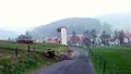
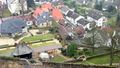
Entering Klein-Gumpen
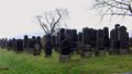
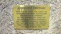
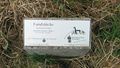
The Jewish cemetery of Reichelsheim
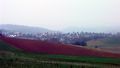
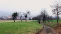
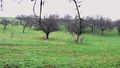
Random landscape shot
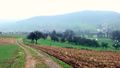
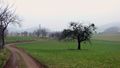
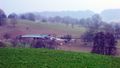
Approaching the hash-orchard
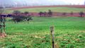
Hash area view with barbed wire fence
This was as close as I got.
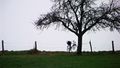
My bike.
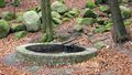
Refilled my water here.
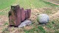
The "Nibelungen Well".
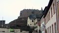
Lindenfels Castle.

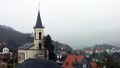
In a Catholic church close to the castle
View to Lindenfels
Some sculpture.
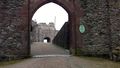
Entering the castle.
Lindenfels again.
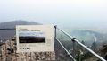
What I could have seen (left); what I was seeing (right).
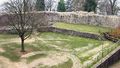
Inner bailey.
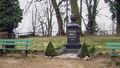
"To its beloved emperor William I. The thankful town of Lindenfels".
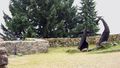
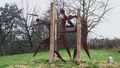
Sculptures along the way from Lindenfels to Fürth.
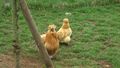
Interesting chicken.