2014-04-19 49 8
| Sat 19 Apr 2014 in Mannheim: 49.6125737, 8.7139176 geohashing.info google osm bing/os kml crox |
Location
Today's location is in a meadow at Bonsweiher, which is a part of Mörlenbach. The meadow is fenced and probably a pasture.
Country: Germany; state: Hessen (Hesse, EU:DE:HE); administrative region: Darmstadt; district: Bergstraße
Weather: Sunny and warm
Expedition
Danatar
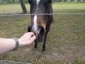
Since I had the time and the weather was nice, I decided to visit this spot for 4 p.m. and take a walk in the countryside. I started at 14:30 by train and went to Weinheim, where I changed into the "Weschnitztalbahn" (Weschnitz valley railroad line). I got off at Mörlenbach and started walking along one of the main roads towards Bonsweiher. There was a sidewalk the whole way, even between the settlements. I enjoyed the sunshine and the green scenery. In Bonsweiher I easily found the hashmeadow, arriving there at 15:40, but the problem was easy to see: It was fenced, probably as a pasture for horses, and the gate was closed. The orchard next to it wasn't closed, so I walked along the fence, but I couldn't get closer than 22 meters. I walked around until 4 p.m., watching and petting the horses that were on various other pastures, but nobody came to the meetup. At least I'm pretty sure that the old man with the electric wheelchair wasn't a geohasher, since I didn't see neither a GPS unit nor a map on him. At 4 p.m. I started on my way back to the Mörlenbach train station, where I arrived with ample time until the next train. Again I had to change trains at Weinheim, so that I could arrive at home after a journey of three hours.
Danatar earned the No trespassing consolation prize
|
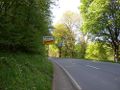
leaving Mörlenbach
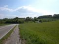
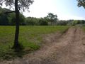
reaching Bonsweiher
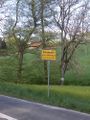
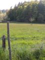
no trespassing
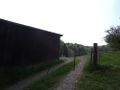
open gate
looking at the hashpoint from as near as I could get
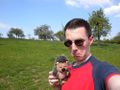
coordinates not reached
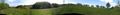
panorama near the hashpoint
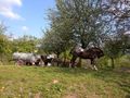
horses
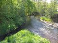
the Mörlenbach creek flowing into the Weschnitz
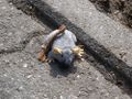
plush mouse on the sidewalk between Mörlenbach and Bonsweiher

the hairdresser world champion is from Bonsweiher


tracklog
triton tracklog The batteries died near the hashpoint. I thought it was after I reached the nearest spot on the fence, but that part is missing from the tracklog, too.