2014-09-18 43 -85
| Thu 18 Sep 2014 in 43,-85: 43.3377254, -85.4500398 geohashing.info google osm bing/os kml crox |
Location
Under a power line right-of-way, Pierson, MI, USA
Participants
Expedition
I was on the hook to pick up Rebekah from her volunteer gig north of town, and when I checked the hashpoint I saw that it was just a little farther north, and looked easily accessible: it was on a power line right-of-way that clearly ran where there used to be a road. So we set out from the volunteer place confidently.
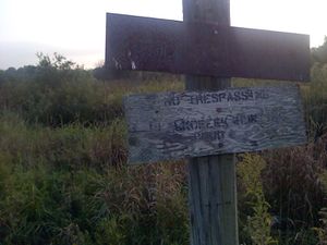
After navigating the unpaved rural roads we arrived at the intersection of Peakpe and Cannonsville roads where we had expected to turn west and drive for a short way before we had to park and walk. Instead we encountered a Private Drive sign. There was a big fancy gate at this point, but it was standing open, and it appeared to belong to some sort of business, possibly a private hunting area. We decided to leave the car on the public road and walk toward the hashpoint, which was about 500 m away. When we arrived at the place where we had thought from the map we would have to park and walk, we found an actual No Trespassing sign. The right-of-way under the power lines was very thickly overgrown with an irrigation ditch running along it, so it was nearly impassable anyway. So we took No Trespassing pictures and headed for home.
We did encounter a juvenile deer on the way back to paved roads, which leaped nicely for us into the field, but we did not succeed at getting a good picture.
Photos
Achievements
Mcbaneg (talk) and Rebekah earned the No trespassing consolation prize
|


