| Macdonald | Stonewall | Selkirk |
| Morden | Winnipeg | Steinbach |
| Langdon, North Dakota | Grafton, North Dakota | Thief River Falls, Minnesota |
|
Today's location: not yet announced | ||
The Winnipeg, Manitoba graticule is located at (49,-97). It encompasses, of course, Winnipeg, as well as Altona, Winkler, Gretna, Morris, and many other small towns and villages in southern Manitoba. Most of the land is farmland, so most markers will end up in the middle of a field.
If a marker does end up in the middle of a farmer's field, meet at the closest point on the side of the road.
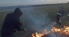
Early and late summer is beautiful with farming in full swing, as well as grass fires.
Former local geohashers
- mmoski: Claimed one expedition (and planned another) in 2008.
- Zach: Claimed one expedition in 2008.
- Jerimiah40: Nothing visited (2008)
- Kabuthunk: Nothing visited (2008)
- Bob: Nothing visited (2009)
- Change on install: Nothing visited (2011)
Notable Dates
- 2008-05-21 and 2008-05-22: mmoski documented "Did it last night, going again tonight."
- 2008-05-24 coordinates were just north of Altona, to the East of Highway 30. Exact coordinates are 49.126648°, -97.547534° Visited by Zach.
- 2008-05-30 was an interesting spot: In a pond in a park in Winnipeg. Nobody went.
