File:2010-06-05 53 10 field.jpg
From Geohashing

Size of this preview: 800 × 600 pixels. Other resolutions: 320 × 240 pixels | 2,304 × 1,728 pixels.
Original file (2,304 × 1,728 pixels, file size: 1.06 MB, MIME type: image/jpeg)
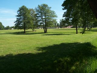
View from the entrance near the bus stop to the field where the geohash is.
The actual location is between the tree in the middle of the field and the tree at the right, at the bank of the drainage ditch, roughly where the shadow of the tree comes closest to the ditch.
File history
Click on a date/time to view the file as it appeared at that time.
| Date/Time | Thumbnail | Dimensions | User | Comment | |
|---|---|---|---|---|---|
| current | 14:55, 30 January 2020 | | 2,304 × 1,728 (1.06 MB) | Maintenance script (talk | contribs) |
- You cannot overwrite this file.
File usage
The following 5 pages link to this file: