File:2020-02-01 16.04.59.jpg
From Geohashing
Size of this preview: 291 × 598 pixels. Other resolutions: 116 × 240 pixels | 1,080 × 2,220 pixels.
Original file (1,080 × 2,220 pixels, file size: 324 KB, MIME type: image/jpeg)
Summary
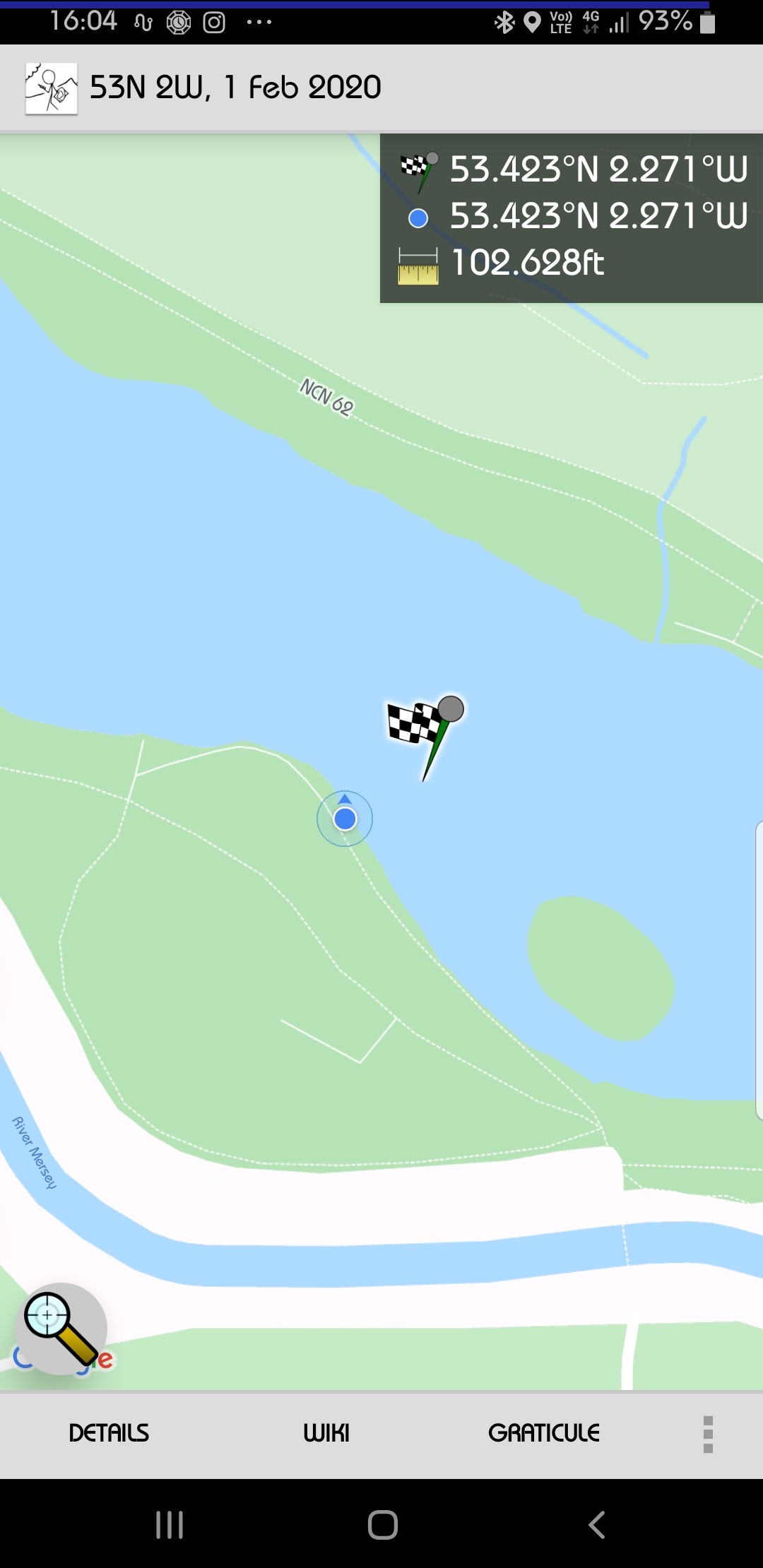
Closest land approach to the 2020-02-01 53 -2 hashpoint, before launching my drone to get the rest of the way.
File history
Click on a date/time to view the file as it appeared at that time.
| Date/Time | Thumbnail | Dimensions | User | Comment | |
|---|---|---|---|---|---|
| current | 17:17, 8 February 2020 | | 1,080 × 2,220 (324 KB) | KarMann (talk | contribs) | Closest land approach to the 2020-02-01 53 -2 hashpoint, before launching my drone to get the rest of the way. |
- You cannot overwrite this file.
File usage
The following page links to this file: