File:Swindon Map 2012.png
From Geohashing
Size of this preview: 498 × 599 pixels. Other resolutions: 199 × 240 pixels | 552 × 664 pixels.
Original file (552 × 664 pixels, file size: 504 KB, MIME type: image/png)
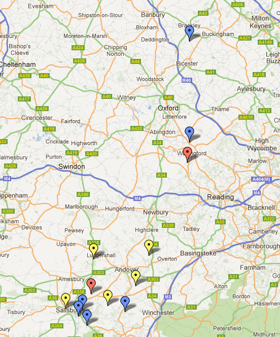
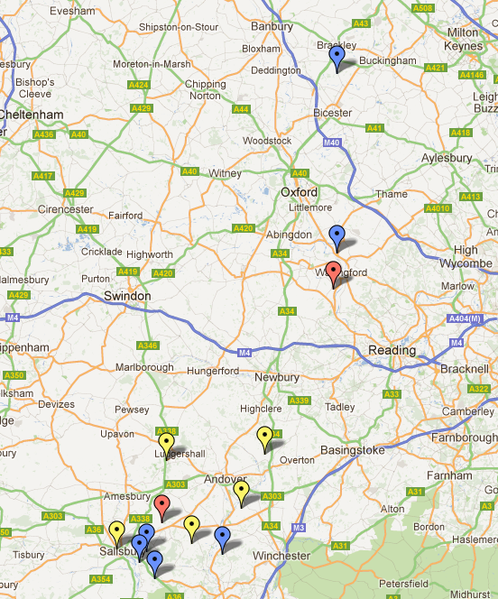
A map of the expeditions launched in the Swindon Graticule in 2012 so far - interactive version.
Blue: Great Success! Yellow: No Proof Red: Abject Failure
File history
Click on a date/time to view the file as it appeared at that time.
| Date/Time | Thumbnail | Dimensions | User | Comment | |
|---|---|---|---|---|---|
| current | 16:58, 30 January 2020 | | 552 × 664 (504 KB) | Maintenance script (talk | contribs) |
- You cannot overwrite this file.
File usage
There are no pages that link to this file.