Juggernaut achievement
Template:Juggernaut achievement
This user earned the Juggernaut achievement
|
From Wikipedia: A juggernaut is a term used to describe a literal or metaphorical force regarded as unstoppable. It is often applied to a large machine or collectively to a team or group of people working together, and often bears association with crushing or being physically destructive.
To gain this achievement, you must attempt to reach a geohash in a straight line from your home, office, or other reasonably permanent location of residence with a deviation of less than 1:20 (see the calculations below). Obstacles should, wherever possible, be overcome instead of circumvented. The minimum distance covered to claim the achievement must be 1km. Your local trespassing laws should, of course, be observed.
You should list the necessary deviation from the straight line as a ratio - Maximum deviation from the straight line : Total distance of the geohash. You may choose freely whether to use a straight line in a commonly used projection system or the great circle as the definition of a straight line. Differences in altitude are not to be considered. If you do not wish to reveal the location of your home or office, you may freely choose a point within 1/20th of the distance to the geohash from your home or office instead of its actual location.
Note: I am not trying to establish a(nother) contest here. I'm after the stories.
Example calculation
The geohash is 18km from your home. During your trip, you have digressed a maximal distance of 500m from the straight line between the two. Hence, your deviation ratio will be 500m:18km = 500:18000 = 1:36 (which, since it represents the fraction 1/36 is less than 1:20 and would qualify you for the achievement.)
Proof
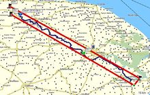
The optimal proof would consist of a GPS tracklog viewed in Google earth or a mapping application. Other options include a video or a series of photos documenting your turns and the obstacles encountered in reasonable depth.

