Difference between revisions of "2008-09-06 33 -118"
imported>SouthLAMike |
|||
| Line 14: | Line 14: | ||
I was going to wait around to see if anyone else would show, even though I was fairly positive no one would, but, it was too bright for me to play my Nintendo DS. So I snapped some photos and was back at the car by 4:45. | I was going to wait around to see if anyone else would show, even though I was fairly positive no one would, but, it was too bright for me to play my Nintendo DS. So I snapped some photos and was back at the car by 4:45. | ||
| + | |||
| + | |||
| + | <gallery caption="Photo Gallery" widths="200px" heights="200px" perrow="2"> | ||
| + | Image:2008-09-06 33 -118 geohash.jpg|Location of geohash | ||
| + | Image:2008-09-06 33 -118 birds.jpg|Birds in LA River | ||
| + | Image:2008-09-06 33 -118 geohasher.jpg|Geohasher on bike path by LA River | ||
| + | Image:2008-09-06 33 -118 river.jpg|The LA River | ||
| + | </gallery> | ||
[[Category:Expeditions]] | [[Category:Expeditions]] | ||
Revision as of 01:07, 7 September 2008
| Sat 6 Sep 2008 in Long Beach: 33.8999133, -118.1865472 geohashing.info google osm bing/os kml crox |
I, Mike, went to check out today's geohash. According to Google Maps, the hash is on the shoulder of the northbound 710 freeway just before the Rosecrans offramp in Compton.
I got there about 4:20 and approached the hash by walking down the adjacent LA River Bike Path from Rosecrans Blvd. Unlike much of the LA River, I was surprised to find the bike path in good shape, and the graffiti was largely abated. Kudos to the City of Paramount. As I walked along the river I saw ducks and other birds playing the in water. To get to the actual location, I ran down the berm that separates the river from the freeway and snapped a picture between the freeway iceplant and the pepper trees.
I was going to wait around to see if anyone else would show, even though I was fairly positive no one would, but, it was too bright for me to play my Nintendo DS. So I snapped some photos and was back at the car by 4:45.
- Photo Gallery
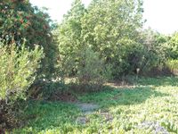
Location of geohash
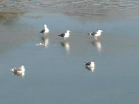
Birds in LA River
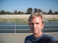
Geohasher on bike path by LA River
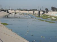
The LA River


