Difference between revisions of "User:Ncbears"
From Geohashing
imported>Ncbears |
imported>Ncbears |
||
| Line 29: | Line 29: | ||
{{land geohash | latitude = 36 | longitude = -78 | date = 2008-12-27 | name = Ncbears | image = Land_Geohash_Proof.jpg}} | {{land geohash | latitude = 36 | longitude = -78 | date = 2008-12-27 | name = Ncbears | image = Land_Geohash_Proof.jpg}} | ||
{{Virgin graticule | latitude = 36 | longitude = -78 | date = 2008-12-27 | name = Ncbears|other=[[User:Ncbears|Ncbears]]|image=12_27_08_Geohashing_N36_W78.jpg}} | {{Virgin graticule | latitude = 36 | longitude = -78 | date = 2008-12-27 | name = Ncbears|other=[[User:Ncbears|Ncbears]]|image=12_27_08_Geohashing_N36_W78.jpg}} | ||
| − | + | ||
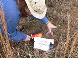
| + | Ncbears submits these proofs of a Hash collision for the [[2009-01-01 36 -75|2009-01-01]] Geohash | ||
| + | Image:01_01_09_Hash_Collision_Proof_2.jpg | ||
| + | Image: | ||
Revision as of 20:52, 1 January 2009
Contents
Who We Are
- Eisen & Bear
What We Are
- Professionals
- Burners
- Love wildlife, esp. bears
- Into hiking, camping, wildlife viewing, and anything German
Expeditions Planned
Hashes Reached
- 36 -75 on 2009-01-01
- 36 -78 on 2008-12-27
Geohash Gallery
Achievements
Ncbears earned the Land geohash achievement
|
Ncbears submits these proofs of a Hash collision for the 2009-01-01 Geohash Image:01_01_09_Hash_Collision_Proof_2.jpg Image:
