Difference between revisions of "Keuruu, Finland"
From Geohashing
imported>Tilley |
imported>Tilley |
||
| Line 12: | Line 12: | ||
| se = [[Jämsä, Finland|Jämsä]] | | se = [[Jämsä, Finland|Jämsä]] | ||
}} | }} | ||
| + | |||
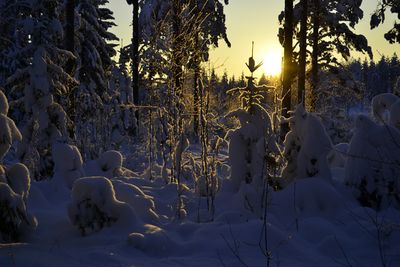
| + | [[File:62_24_Keuruu_DSC1449.jpg|thumb|left|400px|Winter scenery from Keuruu, Finland.]] | ||
This graticule is located at [[62,24]]. [http://carabiner.peeron.com/xkcd/map/map.html?lat=62&long=24&zoom=9&abs=-1 Today's location] | This graticule is located at [[62,24]]. [http://carabiner.peeron.com/xkcd/map/map.html?lat=62&long=24&zoom=9&abs=-1 Today's location] | ||
| + | |||
| + | This graticule belongs to the so-called Middle Finland. The terrain is relatively hilly (in Finnish terms) and acts as a water divider between the rivers of Ostrobothnia and The Lake Päijänne water route. There are lot of forests, swamps and lakes. | ||
| + | |||
| + | The biggest population centers are Keuruu, Multia, Mänttä, Ähtäri ja Karstula. | ||
| + | |||
| + | == Local geohashers == | ||
| + | |||
| + | None. [[User:Tilley|Tilley]] has connections to this graticule and visits it often. | ||
== Meetups == | == Meetups == | ||
Revision as of 07:35, 27 July 2013
| Kokkola | Nivala | Haapajärvi |
| Lapua | Keuruu | Jyväskylä |
| Tampere | Kangasala | Jämsä |
|
Today's location: geohashing.info google osm bing/os kml crox | ||
This graticule is located at 62,24. Today's location
This graticule belongs to the so-called Middle Finland. The terrain is relatively hilly (in Finnish terms) and acts as a water divider between the rivers of Ostrobothnia and The Lake Päijänne water route. There are lot of forests, swamps and lakes.
The biggest population centers are Keuruu, Multia, Mänttä, Ähtäri ja Karstula.
Local geohashers
None. Tilley has connections to this graticule and visits it often.
Meetups
- 1. 2013-07-26 62 24 In Linnanmäki, Multia. Successfully reached by Tilley
