Difference between revisions of "2009-06-28 40 -74"
From Geohashing
imported>Knitting Duck (→Location) |
imported>Knitting Duck (→Plans) |
||
| Line 22: | Line 22: | ||
There's been some chat on the graticule's Facebook group about a meet. Any takers? | There's been some chat on the graticule's Facebook group about a meet. Any takers? | ||
| − | [[User:Knitting Duck|Knitting Duck]] is now the proud owner of a Garmin eTrex Legend H and | + | [[User:Knitting Duck|Knitting Duck]] is now the proud owner of a Garmin eTrex Legend H and a printout of the Google Maps view of the hash. There look to be several options for points at which to enter the woods and reach the hash without crossing the Passaic River on the way. According to a Lincoln Park native, those woods ought to be open to public access. The weather reports are good. Cross your fingers! |
== Expedition == | == Expedition == | ||
Revision as of 06:33, 28 June 2009
| Sun 28 Jun 2009 in 40,-74: 40.9102060, -74.3062207 geohashing.info google osm bing/os kml crox |
Location
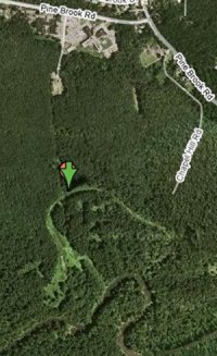
40.910206°, -74.306221°... otherwise known as somewhere in the woods in Lincoln Park, NJ.
Participants
- Knitting Duck and xkcd-unaware friend
Plans
There's been some chat on the graticule's Facebook group about a meet. Any takers?
Knitting Duck is now the proud owner of a Garmin eTrex Legend H and a printout of the Google Maps view of the hash. There look to be several options for points at which to enter the woods and reach the hash without crossing the Passaic River on the way. According to a Lincoln Park native, those woods ought to be open to public access. The weather reports are good. Cross your fingers!
Expedition
Tracklog
Photos
- 2009-
Witty Comment
- 2009-
Witty Comment
