Difference between revisions of "2009-07-11 45 -123"
imported>Jiml (Update report) |
imported>Jiml m (Add links) |
||
| Line 34: | Line 34: | ||
I was too tired to go there and then safely drive home, especially if I went over | I was too tired to go there and then safely drive home, especially if I went over | ||
the hills on curvy roads to avoid driving a long way around (again.) It seems wimpy next | the hills on curvy roads to avoid driving a long way around (again.) It seems wimpy next | ||
| − | to those who bike 11 hours and walk 42km, but I guess that's the way it is. | + | to those who bike [[2008-09-01_49_-124|11 hours]] and [[2009-07-07_49_-122|walk 42km]], but I guess that's the way it is. |
So, I gave up. Hence the lack of knowledge as to exactly where the hashpoint is, and what, | So, I gave up. Hence the lack of knowledge as to exactly where the hashpoint is, and what, | ||
Revision as of 23:09, 12 July 2009
| Sat 11 Jul 2009 in 45,-123: 45.3206566, -123.1604565 geohashing.info google osm bing/os kml crox |
Contents
Location
This hashpoint is near Yamhill, Oregon. Appears to be in an field, which isn't surprising in Yamhill County.
Participants
Plans
I had programmed my GPS Friday and printed out a section of the Google Maps as a guide. There wasn't much planning other than playing with Google Maps to figure out if there was a better route.
Expedition
This was a long day for me. The week itself was long, and I had a lot of errands to get done as well as the local Farmer's market. After all of that, I got home with my slightly molten and non-molten acquisitions and realized I'd forgotten to pick up a birthday cake. I headed back east to pick it up, figured I would loop around to the hashpoint from there. (There are few major roads that crisscross the area, so going 10 miles east to head west might not be that unreasonable timewise!)
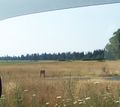
However, when I got to the road I was going to take west, I found I hadn't accounted for traffic. It was fairly busy, and the whole area can be slow going even without traffic. I stopped to look at the Tualatin River Wildlife Refuge to get a break, but then proceeded onward.
After a little further, I realized that while I wasn't too tired to make it to the hashpoint, I was too tired to go there and then safely drive home, especially if I went over the hills on curvy roads to avoid driving a long way around (again.) It seems wimpy next to those who bike 11 hours and walk 42km, but I guess that's the way it is.
So, I gave up. Hence the lack of knowledge as to exactly where the hashpoint is, and what, if anything, is growing in that field right now.
