Difference between revisions of "2009-07-11 48 11"
From Geohashing
imported>Tomcat (New page: {{meetup graticule | map=<map lat="48" lon="11" date="2009-07-11" /> | lat=48 | lon=11 | date=2009-07-11 | graticule_name=München, Germany | graticule_link=München, Germany}} == Expediti...) |
imported>Dawidi m (+Category:Expeditions ... nice panorama btw :)) |
||
| Line 18: | Line 18: | ||
</gallery> | </gallery> | ||
| + | [[Category:Expeditions]] | ||
[[Category:Expeditions with photos]] | [[Category:Expeditions with photos]] | ||
[[Category:Coordinates not reached]] | [[Category:Coordinates not reached]] | ||
Revision as of 13:37, 12 July 2009
| Sat 11 Jul 2009 in München, Germany: 48.3206566, 11.1604565 geohashing.info google osm bing/os kml crox |
Expedition
On our way back from the previous hash in the Augsburg graticule, we would have passed todays Munich hashpoint just 1.1km northeast on the Autobahn - so we decided to give ourselves a second chance for a success.
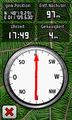
But again, on approaching the coordinates from the northwest via the St2051, we saw that the hashpoint was in the middle of a cropfield and would be unreachable without leaving a 100m track of destruction. Nevertheless, we parked the car on a nearby foresttrack, walked on the road to the point next to the coordinates, took the usual pictures and then headed to a nearby (approx. 600m) geocache (GC10WWH) that we discovered successfully.
Photos
again: coords not reached

360° panoramic view at the hash.
