Difference between revisions of "2009-07-17 50 -1"
From Geohashing
imported>04housemat (→Journey of Matt) |
imported>Mahahahaneapneap (→Success?: Another photo) |
||
| Line 24: | Line 24: | ||
<gallery widths="200px" heights="160px" perrow="3"> | <gallery widths="200px" heights="160px" perrow="3"> | ||
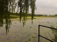
Image:2009-07-17 Hatch Pond 1.JPG| The view over Hatch Pond towards the right location | Image:2009-07-17 Hatch Pond 1.JPG| The view over Hatch Pond towards the right location | ||
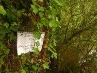
| + | Image:DSC00075 (Medium).JPG| Our sign | ||
Image:2009-07-17 Hatch Pond 2.JPG| Matt's bus ticket | Image:2009-07-17 Hatch Pond 2.JPG| Matt's bus ticket | ||
Image:2009-07-17 Hatch Pond 3.JPG| The co-ordinates we reached | Image:2009-07-17 Hatch Pond 3.JPG| The co-ordinates we reached | ||
Revision as of 00:32, 18 July 2009
| Fri 17 Jul 2009 in 50,-1: 50.7448658, -1.9820917 geohashing.info google osm bing/os kml crox |
Location
Right in the middle of Hatch Pond
People present
Journey of Ali
I cycled approximately 1.5 km from my house to this geohash.
Journey of Matt
I took the No 9 bus from Hamworthy to Poole, and then the No 8 bus from Poole to Fleetsbridge.
Success?
Neither of us have access to a boat, and even if we did, it would probably be frowned upon to sail in a nature reserve. Our location on land was approximately 30 metres away from the correct location.
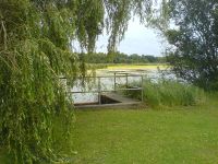
The view over Hatch Pond towards the right location

Our sign
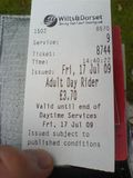
Matt's bus ticket
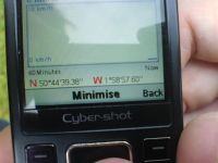
The co-ordinates we reached
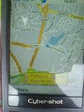
Our location on a map
The tree our poster is on
Another view over the pond
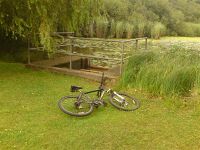
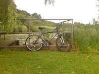
My bike
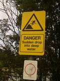
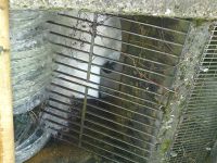
A warning sign - we decided not to swim
My bike
Water flowing out of the pond
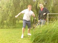
Lovely posing

.JPG)


