Difference between revisions of "2010-04-23 33 -84"
From Geohashing
imported>NWoodruff (→Gallery) |
imported>NWoodruff (→Gallery) |
||
| Line 23: | Line 23: | ||
==== Gallery ==== | ==== Gallery ==== | ||
<gallery perrow="3"> | <gallery perrow="3"> | ||
| − | Image:2010042333-84NW01.JPG | | + | Image:2010042333-84NW01.JPG | 176 feet, as close as I could get. |
| + | Image:2010042333-84NW02.JPG | The time of the meetup. | ||
| + | Image:2010042333-84NW03.JPG | Date of the meetup. | ||
| + | Image:2010042333-84NW04.JPG | It is kind of hard to see but in the center of the picture are 3 fish and the bottom left are 2 fish that swam up expecting to be fed. | ||
| + | Image:2010042333-84NW05.JPG | 11 feet accuracy. | ||
| + | Image:2010042333-84NW06.JPG | The actual hash spot is someone out.... there... | ||
| + | Image:2010042333-84NW07.JPG | It is a very pretty place to be. | ||
| + | Image:2010042333-84NW08.JPG | Me near the hash spot. | ||
| + | Image:2010042333-84NW09.JPG | A great walking trail leads to near the hash spot. | ||
| + | Image:2010042333-84NW10.JPG | My kingdom for a boat? | ||
</gallery> | </gallery> | ||
Revision as of 12:38, 6 June 2010
| Fri 23 Apr 2010 in Atlanta: 33.8186424, -84.5508839 geohashing.info google osm bing/os kml crox |
Graticule
About
A rare water geohash in a subdivision in Mableton Georgia.
Expedition
NWoodruff
Gallery
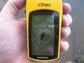
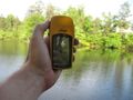
176 feet, as close as I could get.
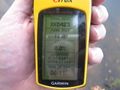
The time of the meetup.
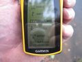
Date of the meetup.
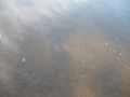
It is kind of hard to see but in the center of the picture are 3 fish and the bottom left are 2 fish that swam up expecting to be fed.
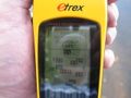
11 feet accuracy.
The actual hash spot is someone out.... there...
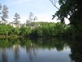
It is a very pretty place to be.

Me near the hash spot.
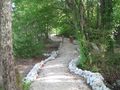
A great walking trail leads to near the hash spot.
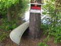
My kingdom for a boat?


