Difference between revisions of "2011-03-17 26 -97"
From Geohashing
imported>Lightrider (→Expedition) |
imported>Lightrider (→Achievements) |
||
| Line 48: | Line 48: | ||
{{#vardefine:ribbonwidth|800px}} | {{#vardefine:ribbonwidth|800px}} | ||
<!-- Add any achievement ribbons you earned below, or remove this section --> | <!-- Add any achievement ribbons you earned below, or remove this section --> | ||
| + | {{land geohash | ||
| + | | latitude = 26 | longitude = -97 | date = 2011-03-17 | name = LightRider | image = 2011_03_17_26_-97_Field.jpg | ||
| + | }} | ||
Revision as of 07:35, 18 March 2011
| Thu 17 Mar 2011 in 26,-97: 26.1891847, -97.7880047 geohashing.info google osm bing/os kml crox |
Location
This is just a field in a suburban area of Harlingen, TX.
Participants
Plans
Expedition
Drove approximately 7 miles to get here from a friend's house, that is after some shoddy GPS direction and navigation errors, but I finally made it to an empty field! Attempted to upload this on-site via Android app, but recieved errors when attempting to do so. Finally able to upload account at home computer!
Tracklog
Photos
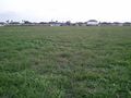
The field...
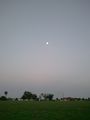
and the moon.


Achievements
LightRider earned the Land geohash achievement
|