Difference between revisions of "2011-05-22 52 12"
From Geohashing
imported>Ekorren (template only by now, more to be added later) |
imported>FippeBot m (Location) |
||
| (One intermediate revision by one other user not shown) | |||
| Line 19: | Line 19: | ||
== Photos == | == Photos == | ||
| + | |||
| + | <gallery> | ||
| + | File:2011-05-22_52_12_train.JPG|Arriving at... | ||
| + | File:2011-05-22_52_12_Bf_Paulinenaue_name.JPG|Paulinenaue | ||
| + | File:2011-05-22_52_12_Bf_Paulinenaue.JPG| | ||
| + | File:2011-05-22_52_12_landscape_1.JPG|Random impression | ||
| + | File:2011-05-22_52_12_way_1.JPG| | ||
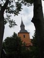
| + | File:2011-05-22_52_12_swedish_tower.JPG|Swedish tower - probably from the 17th century? | ||
| + | File:2011-05-22_52_12_church_1.JPG| | ||
| + | File:2011-05-22_52_12_church_2.JPG| | ||
| + | File:2011-05-22_52_12_way_2.JPG| | ||
| + | File:2011-05-22_52_12_GPS.JPG|Not reached | ||
| + | File:2011-05-22_52_12_Hashpoint.JPG|The hashpoint is over there | ||
| + | File:2011-05-22_52_12_Hashflower.JPG|Near-hash-flower | ||
| + | File:2011-05-22_52_12_Kotzen.JPG|"to vomit". That actually ''is'' the name of the place. | ||
| + | File:2011-05-22_52_12_crash_sign.JPG|We don't care about your heap of scrap metal, but please leave our trees undamaged | ||
| + | File:2011-05-22_52_12_Ribbeck_castle.JPG|Ribbeck castle | ||
| + | File:2011-05-22_52_12_Ribbeck_Kirche.JPG| | ||
| + | </gallery> | ||
[[Category:Expeditions]] | [[Category:Expeditions]] | ||
| Line 24: | Line 43: | ||
[[Category:Coordinates not reached]] | [[Category:Coordinates not reached]] | ||
[[Category:Not reached - No public access]] | [[Category:Not reached - No public access]] | ||
| + | {{location|DE|BB|HVL}} | ||
Latest revision as of 06:50, 15 July 2019
| Sun 22 May 2011 in 52,12: 52.6495345, 12.5661950 geohashing.info google osm bing/os kml crox |
Contents
Location
A field in the Kotzen municipality.
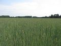
Inaccessible unless you would leave serious damage to the crop.
Participants
Expedition
Report will be done later
Photos
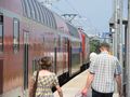
Arriving at...

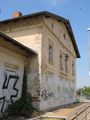
Paulinenaue
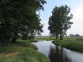
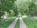
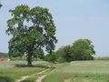
Random impression
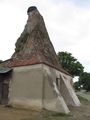
Swedish tower - probably from the 17th century?
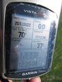
Not reached
The hashpoint is over there
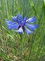
Near-hash-flower
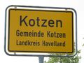
"to vomit". That actually is the name of the place.
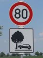
We don't care about your heap of scrap metal, but please leave our trees undamaged
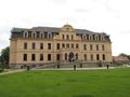
Ribbeck castle