Difference between revisions of "2011-08-02 53 -1"
imported>Monty (Main failure details filled in.) |
imported>Fippe (Location) |
||
| (One intermediate revision by one other user not shown) | |||
| Line 40: | Line 40: | ||
[[Category:Expedition without GPS]] | [[Category:Expedition without GPS]] | ||
[[Category:Coordinates not reached]] | [[Category:Coordinates not reached]] | ||
| − | [[Category:Not reached - No public access]] | + | [[Category:Not reached - No public access]] |
| + | {{location|GB|ENG|BNS}} | ||
Latest revision as of 17:49, 5 July 2019
| Tue 2 Aug 2011 in 53,-1: 53.5473116, -1.5236232 geohashing.info google osm bing/os kml crox |
Location
In the grounds of a haulage company on the outskirts of Barnsley, South Yorkshire, UK.
Participants
Monty attended, way too late in the day.
Plans
Originally, thought I might wander over in the morning, then at dinnertime, then that I'd get away from work quickly enough, but in the end I had other interesting things to do. But it was so close to me that I thought I better pay a casual visit, anyway.
Expedition
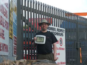
Turned up. Gates closed and locked. Not much more to say, that bears repeating. Photos taken (what a particularly stupid grin!) and ActiveGeohasher page attached to gates in case of Cubicle Geohash interest on the part of those working there.
Tracklog
No tracklog. As per usual.
Photos
A couple of photos to upload, but for now just the Header one...
Achievements
TBA. (Only consolation ones, though.)
