Difference between revisions of "2011-08-31 54 -110"
From Geohashing
imported>B cereus ([retro picture] Proof! [http://www.openstreetmap.org/?lat=54.79456738103181&lon=-110.37069283425808&zoom=16&layers=B000FTF @54.7946,-110.3707]) |
imported>B cereus ([retro picture] [http://www.openstreetmap.org/?lat=54.7818137&lon=-110.5702042&zoom=16&layers=B000FTF @54.7818,-110.5702]) |
||
| Line 45: | Line 45: | ||
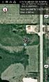
Image:2011-08-31_54_-110_07-16-40-678.jpg | Proof! [http://www.openstreetmap.org/?lat=54.79456738103181&lon=-110.37069283425808&zoom=16&layers=B000FTF @54.7946,-110.3707] | Image:2011-08-31_54_-110_07-16-40-678.jpg | Proof! [http://www.openstreetmap.org/?lat=54.79456738103181&lon=-110.37069283425808&zoom=16&layers=B000FTF @54.7946,-110.3707] | ||
| + | |||
| + | Image:2011-08-31_54_-110_07-18-28-253.jpg | [http://www.openstreetmap.org/?lat=54.7818137&lon=-110.5702042&zoom=16&layers=B000FTF @54.7818,-110.5702] | ||
</gallery> | </gallery> | ||
Revision as of 13:18, 1 September 2011
| Wed 31 Aug 2011 in 54,-110: 54.2882548, -110.7573804 geohashing.info google osm bing/os kml crox |
Location
Participants
Plans
Will try to make out to this easy hash point on my way to the bombing range for work. -- B cereus @53.4771,-113.6483 12:45, 31 August 2011 (EDT)
Expedition
Made it! Luckily the barbed wire fence had a loose wire so I could squeeze though. After dodging a minefield of cow pies, I made it to the hash point.
Tracklog
Photos
Proof! @54.7946,-110.3707


Achievements