Difference between revisions of "2011-09-19 44 -117"
From Geohashing
imported>Michael5000 m (Created page with "{{subst:Expedition |lat = 44 |lon = -117 |date = 2011-09-19 }}") |
imported>Michael5000 m |
||
| Line 1: | Line 1: | ||
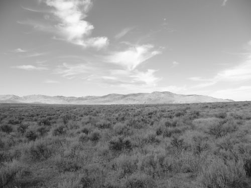
| + | [[File:2011-09-18 42 -115 2a.jpg|thumb|none|500 px|Ansel Adams I'm not.]] | ||
| − | |||
| − | |||
| − | |||
| − | |||
| − | |||
| − | |||
| − | |||
| − | |||
| − | |||
| − | |||
| − | |||
| − | |||
| − | |||
| − | |||
| − | |||
__NOTOC__ | __NOTOC__ | ||
== Location == | == Location == | ||
| − | + | ||
| + | Two miles off of Highway 78 on the Silver City road. | ||
== Participants == | == Participants == | ||
| − | |||
| − | + | *[[User:Michael5000|Michael5000]] | |
| − | + | ||
== Expedition == | == Expedition == | ||
| − | |||
| − | + | I rolled up to the hashpoint at 11:04 local time, but not surprisingly there were not throngs of local geohashers out to join me along the Owyhee Front. Traveling geohashes don't get much simpler: the Silver City Road, which apparently gets pretty rugged up in the hills but is perfectly well-behaved down in the desert flat, brought me to within a well-chucked stone's throw of the hashpoint. I wandered out into the sagebrush, enjoyed the views, communed with nature, took my photographs, etc., and then set course for further adventures! | |
| − | |||
== Photos == | == Photos == | ||
| + | |||
<!-- Insert pictures between the gallery tags using the following format: | <!-- Insert pictures between the gallery tags using the following format: | ||
Image:2010-##-## ## ## Alpha.jpg | Witty Comment | Image:2010-##-## ## ## Alpha.jpg | Witty Comment | ||
| Line 45: | Line 30: | ||
<!-- =============== USEFUL CATEGORIES FOLLOW ================ | <!-- =============== USEFUL CATEGORIES FOLLOW ================ | ||
| − | |||
| − | |||
<!-- Potential categories. Please include all the ones appropriate to your expedition --> | <!-- Potential categories. Please include all the ones appropriate to your expedition --> | ||
Revision as of 06:31, 20 September 2011
Location
Two miles off of Highway 78 on the Silver City road.
Participants
Expedition
I rolled up to the hashpoint at 11:04 local time, but not surprisingly there were not throngs of local geohashers out to join me along the Owyhee Front. Traveling geohashes don't get much simpler: the Silver City Road, which apparently gets pretty rugged up in the hills but is perfectly well-behaved down in the desert flat, brought me to within a well-chucked stone's throw of the hashpoint. I wandered out into the sagebrush, enjoyed the views, communed with nature, took my photographs, etc., and then set course for further adventures!
