Difference between revisions of "1964-02-21 59 18"
From Geohashing
imported>Cjk ([retro picture] Confused gps [http://www.openstreetmap.org/?lat=59.34360000&lon=18.09370000&zoom=16&layers=B000FTF @59.3436,18.0937]) |
imported>Cjk ([retro picture] Art?) |
||
| Line 39: | Line 39: | ||
Image:1964-02-21_59_18_12-29-17-366.jpg | Confused gps [http://www.openstreetmap.org/?lat=59.34360000&lon=18.09370000&zoom=16&layers=B000FTF @59.3436,18.0937] | Image:1964-02-21_59_18_12-29-17-366.jpg | Confused gps [http://www.openstreetmap.org/?lat=59.34360000&lon=18.09370000&zoom=16&layers=B000FTF @59.3436,18.0937] | ||
| + | |||
| + | Image:1964-02-21_59_18_14-44-42-581.jpg | Art? | ||
</gallery> | </gallery> | ||
Revision as of 13:44, 9 February 2012
| Fri 21 Feb 1964 in 59,18: 59.3435274, 18.0937766 geohashing.info google osm bing/os kml crox |
Location
Participants
Plans
Expedition
Tracklog
Photos

Confused gps @59.3436,18.0937
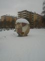
Art?


Achievements