Difference between revisions of "2012-03-04 -8 -35"
imported>Mtsmnds |
imported>Fippe (Location) |
||
| (9 intermediate revisions by 2 users not shown) | |||
| Line 59: | Line 59: | ||
Image:2010-##-## ## ## Alpha.jpg | Witty Comment | Image:2010-##-## ## ## Alpha.jpg | Witty Comment | ||
--> | --> | ||
| − | + | {{gallery|width=200|height=200|lines=2 | |
| − | + | ||
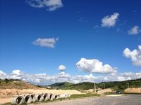
| − | + | |File:2012-03-04_-8_-35_1.jpg|View of some houses being built in Moreno | |
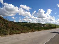
| + | |File:2012-03-04_-8_-35_2.jpg|View from the gas station | ||
| + | |File:Photo 04-03-2012 15 22 34.jpg|under a bridge on the highway | ||
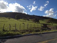
| + | |File:2012-03-04_-8_-35_6.jpg|One of the peaceful views of the farmlands around Gravatá | ||
| + | |File:Photo 04-03-2012 16 37 20.jpg| | ||
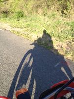
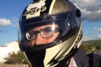
| + | |File:Photo 05-03-2012 01 42 34.png|myself facing the unrelenting sun | ||
| + | }} | ||
== Achievements == | == Achievements == | ||
| Line 67: | Line 73: | ||
<!-- Add any achievement ribbons you earned below, or remove this section --> | <!-- Add any achievement ribbons you earned below, or remove this section --> | ||
| − | |||
| − | |||
| − | |||
| − | |||
| Line 78: | Line 80: | ||
[[Category:Coordinates not reached]] | [[Category:Coordinates not reached]] | ||
[[Category:Not reached - Technology]] | [[Category:Not reached - Technology]] | ||
| − | |||
| − | |||
| − | |||
| − | |||
[[Category:Expeditions with photos]] | [[Category:Expeditions with photos]] | ||
| − | + | {{location|BR|PE}} | |
| − | |||
| − | |||
| − | |||
| − | |||
| − | |||
| − | |||
| − | |||
| − | |||
| − | |||
| − | |||
| − | |||
| − | |||
| − | |||
| − | |||
| − | |||
Latest revision as of 13:12, 2 June 2019
| Sun 4 Mar 2012 in -8,-35: -8.0667660, -35.7207607 geohashing.info google osm bing/os kml crox |
Location
About 7 kilometers to the east of the village of Ameixas, itself 17km to the north of Bezerros, closest town crossed by a major highway, the BR-232.
Participants
Plans
None. Been building up courage to do my first geohash, this felt like a good spot, close to a road. the night after I took a look at sunday hashes and felt it would be this one.
Expedition
This was not the closest hash point that I have seen but the day where I felt most inclined to do it. I left home late, 2 pm, and decided that I didn't need to shower since I would be alone for hours riding my bike and would certainly meet no one else there. With me, my bike, my iphone and some stuff that can't yet be called a emergency equipment bag, but enough to transport a broken bike on the back of a truck or repair a simple flat.
The route was laid out on Maps app, and was mostly not followed. The plan was to get the BR-232 highway to Bezerros, covering 108km and the go up the PE-097 to ameixas and beyond, find a spot where I could go off road to reach my objective. After reaching the hash location I would go up back to the road and do what we call here in Recife "o Balão" [the ballon] going through the local roads [PE stands for pernambuco, the state, whereas BR stands for Brazil, so, state kept roads and country kept roads] until Pombos where I would get back to the BR-232 on my way back to Recife.
I went for a good start, missing the entrance to the highway, then missing it again, and one more time. I stopped on the shoulder below a viaduct to take a look at the map on my phone and see what I should do, I did it the wrong way and the guessing part of me kicked in. I exited the highway I was in [BR-101] in any entrance and made my way west, choosing roads that seemed good. I often do that when looking for a place, it usually works but takes long and its not a good habit.
While having a lost status sometimes you feel you're going the right way, some times you get frightened. so I went on and on, the same road, passing buses and cars, sometimes the road looked like it would sease to exist, or become a stone road instead of asphalt, which for me is a sign that the road is leading to a residential area or ending, not the highway. This road led me to Jaboatao, and the it was ok, after Jaboatao, the same road became PE-007, so my phone told me [there weren't many road signs in this trip, neither there are in the small towns around here], a well paved winding road that showed me some beatiful scenery and the expansion of the residential part of Moreno, the next city I found.
After Moreno, PE-007 merged with BR-232 and I could go on my predicted route, a few km until Vitoria de Santo Antão, where I refueled, then Pombos there the BR starts to go up the Serra [I could only describe it as a mountain range, but of small hills] leading to Gravatá on top of it, and then finally Bezerros. Took a rest there, got off the bike to walk a little bit. Figured out my way to Ameixas.
The real route I used to cross Bezerros and get to PE-097 was guesswork, as the city has little signs and I don't like to stop to ask directions. I found my self with no problems, getting relieved when I passed a sign already telling me in which km of the road I was at the moment.
So, going north on PE-097 I find myself surprised by the good quality of such an unimportant road. It stops being asphalt on every little town it crosses, which is a nice touch to avoid people speeding all along it. I came to my destination, the small town of Cumaru [when I say small, I say you can't see it on google maps, they are sometimes just some houses along the road, the rest is farmlands and such, I don't know a name for something smaller than a town], at that point I had no cell reception, which was awful. I decided that this would be my closest to the hash this time, and pressed on, already afraid of having to ride a lot at night, as I have left home so late.
My initial idea was to return by the same BR-232 but that did not come true, I followed the winding path just north of it, no cities to be seen for a long time. The mountain range that I told by my right now that I was returning, on a small descent, until the city of limoeiro, from where we can see the undersized replica of Christ the Redeemer on top of a hill in Pombos.
It goes nice and easy until I reached Carpina, from this city on they are building new roads to suit the volume of traffic in 2014 world cup, it was already night and this road, still under construction, although well paved has no lights and many obstacles on the incomplete lanes, that changed the pace of a nice way back to a stressful but exciting ride on pitch black darkness, relying only on my newly installed lights, a little bit stronger than the standard issue for my motorcycle.
then I have no more to tell you, I meet my city again, it is marked by a distinctive cloud formation just above it, that can be seen from afar, don't take my word for it but I came to the conclusion that this must be a cloud of pollution, not the most welcoming sight. already on the city I realized there were also two bikers returning from a little trip, we were on the same path for half an hour, we just stuck together on this bit, and parted when they continued on their way to Olinda, myself stopping in Recife.
Tracklog
no track log, but may I show you a map with the aproximate path?
Google Maps Recount of the roads of my choice
my odometer showed 275 km total
Photos
|

