Difference between revisions of "2012-03-21 59 17"
From Geohashing
imported>Zeot ([live picture] The ring and my dirty feet [http://www.openstreetmap.org/?lat=59.06440000&lon=17.50410000&zoom=16&layers=B000FTF @59.0644,17.5041]) |
imported>Zeot (→Photos) |
||
| Line 45: | Line 45: | ||
Image:2012-03-21_59_17_20-28-59-880.jpg | Picnic at the hashpoint [http://www.openstreetmap.org/?lat=59.06260000&lon=17.49110000&zoom=16&layers=B000FTF @59.0626,17.4911] | Image:2012-03-21_59_17_20-28-59-880.jpg | Picnic at the hashpoint [http://www.openstreetmap.org/?lat=59.06260000&lon=17.49110000&zoom=16&layers=B000FTF @59.0626,17.4911] | ||
| − | Image:2012-03-21_59_17_22-58-41-784.jpg | The ring and | + | Image:2012-03-21_59_17_22-58-41-784.jpg | The ring and [[user:zeot|zeot's]] dirty feet [http://www.openstreetmap.org/?lat=59.06440000&lon=17.50410000&zoom=16&layers=B000FTF @59.0644,17.5041] |
</gallery> | </gallery> | ||
Revision as of 21:59, 21 March 2012
| Wed 21 Mar 2012 in 59,17: 59.0625513, 17.4909986 geohashing.info google osm bing/os kml crox |
Location
Participants
Plans
- Taking the commuter train from Stockholm C around 1730 with Henrik, Toni and Anton -- zeot @59.3142,18.0538 17:50, 20 March 2012 (EDT)
Expedition
Tracklog
Photos
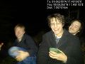
Picnic at the hashpoint @59.0626,17.4911
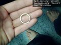
The ring and zeot's dirty feet @59.0644,17.5041


Achievements