Difference between revisions of "2012-06-06 32 -117"
From Geohashing
imported>Mathgeek ([live picture] Hanging off the hillside. [http://www.openstreetmap.org/?lat=32.92831310&lon=-117.11177227&zoom=16&layers=B000FTF @32.9283,-117.1118]) |
imported>JesseW (add more complete address) |
||
| Line 9: | Line 9: | ||
== Location == | == Location == | ||
<!-- where you've surveyed the hash to be --> | <!-- where you've surveyed the hash to be --> | ||
| − | Up an embankment just east of the 15, just south of Scripps Poway Pkwy; the closest road is Cortina | + | Up an embankment just east of the 15, just south of Scripps Poway Pkwy; the closest road is 11518 Cortina Pl. San Diego, CA 92131 |
== Participants == | == Participants == | ||
Revision as of 01:27, 7 June 2012
| Wed 6 Jun 2012 in 32,-117: 32.9283575, -117.1117727 geohashing.info google osm bing/os kml crox |
Location
Up an embankment just east of the 15, just south of Scripps Poway Pkwy; the closest road is 11518 Cortina Pl. San Diego, CA 92131
Participants
Plans
Drive up the 15, maybe stop along the side if possible. Then drive up to the housing development, and try and walk around the houses to get to the actual hashpoint. It'd be nice to meet up with other hashers, so I'll wait until Noon before deciding on a time -- please post here (and/or email me) if you are thinking of going. I'll be in a white HOnda Accord.
Expedition
- Actually made this one today... Kinda hanging off a steep slope but it is a great view. -- Mathgeek @32.9283,-117.1117 16:34, 6 June 2012 (PDT)
Tracklog
Photos
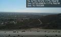
Hanging off the hillside. @32.9283,-117.1118

Achievements