Difference between revisions of "2012-06-24 50 10"
From Geohashing
imported>Reinhard (report) |
imported>Reinhard m (→Expedition) |
||
| Line 14: | Line 14: | ||
== Expedition == | == Expedition == | ||
| − | Weather wasn't worse than [[2012-06-23_50_10|yesterday]], so I tried to reach an other geohash by bike. I got to Mönchshof easily and rode a circle around it to find the best access to the hash spot. Found a field path passing in a distance of about 150 m. Could continue walking on a harvested field and finally in a currently unused field (several types of | + | Weather wasn't worse than [[2012-06-23_50_10|yesterday]], so I tried to reach an other geohash by bike. I got to Mönchshof easily and rode a circle around it to find the best access to the hash spot. Found a field path passing in a distance of about 150 m. Could continue walking on a harvested field and finally in a currently unused field (several types of plants) and saw it would end with a decision of millimeters, whether I could reach the spot or it would be behind a fence on a paddock with horses. Of course, it turned out I didn't reach it by 16 meters. Again, I wasn't too much disappointed as the geohash's main task today was to tell me, where I could ride my bike. |
| − | |||
== Photos == | == Photos == | ||
Revision as of 18:06, 24 June 2012
| Sun 24 Jun 2012 in 50,10: 50.3918425, 10.4812542 geohashing.info google osm bing/os kml crox |
Location
On a paddock in Mönchshof near Römhild / Hildburghausen.
Participants
Expedition
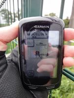
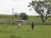
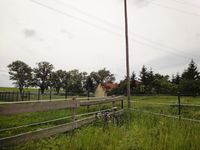
Weather wasn't worse than yesterday, so I tried to reach an other geohash by bike. I got to Mönchshof easily and rode a circle around it to find the best access to the hash spot. Found a field path passing in a distance of about 150 m. Could continue walking on a harvested field and finally in a currently unused field (several types of plants) and saw it would end with a decision of millimeters, whether I could reach the spot or it would be behind a fence on a paddock with horses. Of course, it turned out I didn't reach it by 16 meters. Again, I wasn't too much disappointed as the geohash's main task today was to tell me, where I could ride my bike.
Photos
|


