Difference between revisions of "2012-08-04 47 -122"
From Geohashing
imported>Thomcat (A bit of history) |
imported>Thomcat ([live picture] Licton Springs - the Iron Spring. Waiting for others. [http://www.openstreetmap.org/?lat=47.69918775&lon=-122.33916413&zoom=16&layers=B000FTF @47.6992,-122.3392]) |
||
| Line 35: | Line 35: | ||
--> | --> | ||
<gallery perrow="5"> | <gallery perrow="5"> | ||
| + | |||
| + | Image:2012-08-04_47_-122_16-10-17-959.jpg | Licton Springs - the Iron Spring. Waiting for others. [http://www.openstreetmap.org/?lat=47.69918775&lon=-122.33916413&zoom=16&layers=B000FTF @47.6992,-122.3392] | ||
</gallery> | </gallery> | ||
Revision as of 23:10, 4 August 2012
| Sat 4 Aug 2012 in 47,-122: 47.6396922, -122.4799171 geohashing.info google osm bing/os kml crox |
Location
In the waters of Puget Sound, yet again.
Alternate Location
The spring in Licton Springs Park.
Licton Springs park is an Iron Spring in North Seattle. You can read more about it here.
Participants
(so far)
Plans
4pm
Expedition
Tracklog
Photos
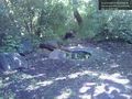
Licton Springs - the Iron Spring. Waiting for others. @47.6992,-122.3392

Achievements
- Thomcat's 10th Saturday meetup.