Difference between revisions of "2012-10-06 38 -94"
From Geohashing
imported>IamaJayhawk (→Photos) |
imported>IamaJayhawk (→Photos) |
||
| Line 19: | Line 19: | ||
<gallery widths="160px" align=center> | <gallery widths="160px" align=center> | ||
File:WP 000026.jpg | File:WP 000026.jpg | ||
| + | File:WP 000027.jpg | ||
| + | File:WP 000028.jpg | ||
File:2012-10-06.PNG | File:2012-10-06.PNG | ||
| + | |||
</gallery> | </gallery> | ||
Revision as of 15:55, 7 October 2012
Location
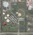
Blackbob Park. Olathe, Kansas
Particitpants
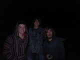
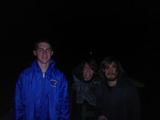
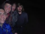
IamaJayhawk 24:00, 10/7/2012 (CST) Enfinety 24:00, 10/7/2012 (CST) Keroro117 24:00, 10/7/2012 (CST) Zeero88 24:00, 10/7/2012 (CST)
Expedition
K-10 to K-7 > K-7 to 151st > 151st to Access Rd
Tracklog
Set out from home, no problems until 151st when we got lost and thought we missed access Rd. Wasted around 20-30 minutes trying to find where the **** we were. Finally arrive at park at 23:51 and wait for midnight before arriving at hash point.
Photos
Achievements
name of achiever IamaJayhawk earned the Midnight Geohash achievement
|
IamaJayhawk earned the Land geohash achievement
|
name of achiever Enfinety earned the Midnight Geohash achievement
|
name of achiever Keroro117 earned the Midnight Geohash achievement
|
name of achiever Zeero88 earned the Midnight Geohash achievement
|


