Difference between revisions of "2013-05-08 61 23"
From Geohashing
imported>Teukkam ([live picture] It's a hash tree... stump. [http://www.openstreetmap.org/?lat=61.32490000&lon=23.83960000&zoom=16&layers=B000FTF @61.3249,23.8396]) |
imported>Teukkam ([live picture] The proximity of the hash point. [http://www.openstreetmap.org/?lat=61.32490000&lon=23.83960000&zoom=16&layers=B000FTF @61.3249,23.8396]) |
||
| Line 50: | Line 50: | ||
Image:2013-05-08_61_23_10-08-18-228.jpg | It's a hash tree... stump. [http://www.openstreetmap.org/?lat=61.32490000&lon=23.83960000&zoom=16&layers=B000FTF @61.3249,23.8396] | Image:2013-05-08_61_23_10-08-18-228.jpg | It's a hash tree... stump. [http://www.openstreetmap.org/?lat=61.32490000&lon=23.83960000&zoom=16&layers=B000FTF @61.3249,23.8396] | ||
| + | |||
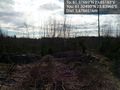
| + | Image:2013-05-08_61_23_10-10-13-246.jpg | The proximity of the hash point. [http://www.openstreetmap.org/?lat=61.32490000&lon=23.83960000&zoom=16&layers=B000FTF @61.3249,23.8396] | ||
</gallery> | </gallery> | ||
Revision as of 07:10, 8 May 2013
| Wed 8 May 2013 in 61,23: 61.3755020, 23.8518256 geohashing.info google osm bing/os kml crox |
Location
In Northern Lempäälä, north of Savontie. Close to the "Savontien EK" geocache.
Participants
Plans
Ride to the scene on my BoostBike, check out the geohash and the above mentioned geocache. Most likely it isn't eligible for Hash collision, but depending on the topology of the area, it might be.
Expedition
- Found the geocache! -- TeukkaM (talk) @61.3704,23.8560 09:34, 8 May 2013 (EEST)
Tracklog
Photos
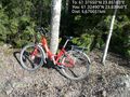
Parked my ride near the geocache @61.3249,23.8396
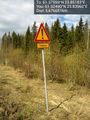
Horses. Again. @61.3249,23.8396
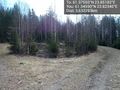
Turning point for forestry vehicles. Parked here. @61.3459,23.8234
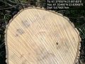
It's a hash tree... stump. @61.3249,23.8396
The proximity of the hash point. @61.3249,23.8396


Achievements