imported>Slini11 |
imported>Mampfred |
| (8 intermediate revisions by 2 users not shown) |
| Line 1: |
Line 1: |
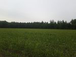
| − | {{meetup graticule | + | {{ GalleryItem | File:2013-06-13 20.34.48.jpg | Winterswijk, Netherlands (netherland field, german forest) | 2013-06-13 51 6 }} |
| − | | lat=51
| + | {{ GalleryItem | File:20130613-55-13-03-The-grin.JPG | Rickarum, Kristianstad, Skåne, Sweden | 2013-06-13 55 13 }} |
| − | | lon=06
| |
| − | | date=2013-06-13 | |
| − | }}
| |
| − | | |
| − | == Location ==
| |
| − | | |
| − | The cooridnates are located on a field 50 meters away from the Drawsway in the Netherlands.
| |
| − | The Hash was about 175 m away from the german border.
| |
| − | | |
| − | == Participants ==
| |
| − | | |
| − | [[User:Slini11|Slini11]]
| |
| − | | |
| − | == Expeditions ==
| |
| − | Everyday I looked at the "Geo Hashing"-Map and waited for a day where a Hash comes near my home.
| |
| − | Today it was only 5 km away, but in the Netherlands. The weather was rainy so we drove by car to the Hash.
| |
| − | It was only 50 meters away from the Drawsway, that was next to the field on which the Hash was located.
| |
| − | | |
| − | | |
| − | == Gallery ==
| |
| − | <gallery>
| |
| − | File:2013-06-13 20.32.25.jpg|parking area | |
| − | File:2013-06-13 20.34.40.jpg|0m
| |
| − | File:2013-06-13 20.34.48.jpg|north view | |
| − | File:2013-06-13 20.34.56.jpg|east view
| |
| − | File:2013-06-13 20.35.09.jpg|south view
| |
| − | File:2013-06-13 20.35.03.jpg|south view
| |
| − | File:2013-06-13 20.35.48.jpg|ground zero
| |
| − | </gallery>
| |
| − | | |
| − | == Achievements ==
| |
| − | | |
| − | no achievements earned yet
| |
| − | | |
| − | [[Category:Expeditions]]
| |
| − | [[Category:Expeditions with photos]]
| |
| − | [[Category:Coordinates reached]]
| |

