Difference between revisions of "2013-07-27 43 -116"
From Geohashing
imported>Eldin ([live picture] Grin [http://www.openstreetmap.org/?lat=43.87250000&lon=-116.49900000&zoom=16&layers=B000FTF @43.8725,-116.4990]) |
imported>Eldin ([live picture] Point [http://www.openstreetmap.org/?lat=43.87250000&lon=-116.49900000&zoom=16&layers=B000FTF @43.8725,-116.4990]) |
||
| Line 3: | Line 3: | ||
<gallery> | <gallery> | ||
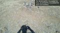
Image:2013-07-27_43_-116_16-31-52-115.jpg | Grin [http://www.openstreetmap.org/?lat=43.87250000&lon=-116.49900000&zoom=16&layers=B000FTF @43.8725,-116.4990] | Image:2013-07-27_43_-116_16-31-52-115.jpg | Grin [http://www.openstreetmap.org/?lat=43.87250000&lon=-116.49900000&zoom=16&layers=B000FTF @43.8725,-116.4990] | ||
| + | |||
| + | Image:2013-07-27_43_-116_16-32-23-198.jpg | Point [http://www.openstreetmap.org/?lat=43.87250000&lon=-116.49900000&zoom=16&layers=B000FTF @43.8725,-116.4990] | ||
</gallery> | </gallery> | ||
Revision as of 22:32, 27 July 2013
| Sat 27 Jul 2013 in 43,-116: 43.9516838, -116.4488184 geohashing.info google osm bing/os kml crox |
{{subst:#ifeq: f|t| | }}
{{subst:#ifeq: t|f| |
Location
In the hills NE of Emmet }}
{{subst:#ifeq: t|f| |
Participants
}}
{{subst:#ifeq: t|f| |
Plans
I'll try to reach the point this afternoon. }}
{{subst:#ifeq: t|f| |
Expedition
}}
{{subst:#ifeq: f|f| |
Tracklog
}}
{{subst:#ifeq: t|f| |
Photos
}}
{{subst:#ifeq: {{{show_achievements}}}|f| |
Achievements
}}
- At the point! -- Eldin (talk) @43.9517,-116.4488 16:29, 27 July 2013 (MDT)

Grin @43.8725,-116.4990
Point @43.8725,-116.4990

