Difference between revisions of "2013-09-27 55 37"
From Geohashing
imported>Vb ([live picture] New bicycle sharing system. Unrelated. [http://www.openstreetmap.org/?lat=55.70620000&lon=37.55450000&zoom=16&layers=B000FTF @55.7062,37.5545]) |
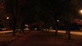
imported>Vb ([live picture] Midnight [http://www.openstreetmap.org/?lat=55.70652510&lon=37.56582821&zoom=16&layers=B000FTF @55.7065,37.5658]) |
||
| Line 54: | Line 54: | ||
Image:2013-09-27_55_37_23-47-03-718.jpg | New bicycle sharing system. Unrelated. [http://www.openstreetmap.org/?lat=55.70620000&lon=37.55450000&zoom=16&layers=B000FTF @55.7062,37.5545] | Image:2013-09-27_55_37_23-47-03-718.jpg | New bicycle sharing system. Unrelated. [http://www.openstreetmap.org/?lat=55.70620000&lon=37.55450000&zoom=16&layers=B000FTF @55.7062,37.5545] | ||
| + | |||
| + | Image:2013-09-27_55_37_00-01-42-271.jpg | Midnight [http://www.openstreetmap.org/?lat=55.70652510&lon=37.56582821&zoom=16&layers=B000FTF @55.7065,37.5658] | ||
</gallery> | </gallery> | ||
Revision as of 20:01, 26 September 2013
| Fri 27 Sep 2013 in 55,37: 55.7064000, 37.5644503 geohashing.info google osm bing/os kml crox |
Location
Kosygin street
Participants
Plans
Expedition
- On the question of google maps satellite imagery accuracy. My phone's GPS consistently shows hash about 6m away from what it appears on the map - across the road. -- vb (talk) 15:12, 26 September 2013 (EDT)
Tracklog
Photos
1hr too early

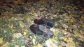
@55.7064,37.5645 somebody left their galoshes near the hash.
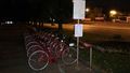
New bicycle sharing system. Unrelated. @55.7062,37.5545
Midnight @55.7065,37.5658


Achievements