Difference between revisions of "2013-11-09 47 -121"
imported>Rex Wolf (Added photos) |
imported>FippeBot m (Location) |
||
| (One intermediate revision by one other user not shown) | |||
| Line 43: | Line 43: | ||
== Tracklog == | == Tracklog == | ||
<!-- if your GPS device keeps a log, you may post a link here --> | <!-- if your GPS device keeps a log, you may post a link here --> | ||
| + | [[:Image:Rex-Snoqualmie-2013-11-09-tracklog.png|Rex's tracklog as PNG.]] | ||
== Photos == | == Photos == | ||
| Line 113: | Line 114: | ||
(Don't forget to delete this final close comment marker) --> | (Don't forget to delete this final close comment marker) --> | ||
| + | {{location|US|WA|KT}} | ||
Latest revision as of 04:36, 14 August 2019
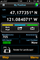
| Sat 9 Nov 2013 in Snoqualmie: 47.1787627, -121.0892742 geohashing.info google osm bing/os kml crox |
Location
On a driveway off Goat Peak Ranch Road. (!)
Participants
Plans
We're going to attempt to get out here for the 4pm Saturday meetup. Might be a bit late, but we're certainly going to give it a good shot!
Expedition
We were a bit late heading out to the hashpoint, and it was almost dark by the time we reached the vicinity. Largely, this was a combination of dense cloud, rain, time, and northern latitude. (We weren't more than an hour late, if that!)
Got turned around several times, due to a mismatch between my GPS maps and the actual layout of the roads. Google Maps was more correct, but wasn't able to be accessed from my phone, so we had to stop and pull out a phone that had a working data plan in order to figure out where to go.
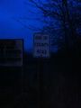
And wouldn't you know it, there's a big PRIVATE PROPERTY sign there! :( No hashpoint for us today, it seems...
Tracklog
Photos
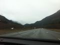
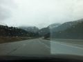
It gets a little mountainous in this graticule.
You can just see the outline of more mountains through the cloud.
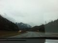
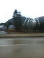
More mountains (and motion blur!).
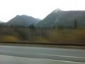
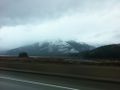
I'll bet the road winds through there, doesn't it?
Seems like it does.
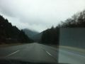
I'll bet this could be great skiing in the winter...
Looking across the lake flats.
The road ends here...
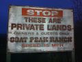
...and we're not going any further.
This was as close as I could get.


Achievements
Rex earned the No trespassing consolation prize
|