Difference between revisions of "2008-05-28 39 -105"
From Geohashing
imported>Mgashwood |
imported>Mgashwood |
||
| Line 11: | Line 11: | ||
| − | =Summary= | + | ==Summary== |
The SW [[Denver, Colorado|Denver]] location today ([http://irc.peeron.com/xkcd/map/map.html?date=2008-05-28&lat=39&long=-106&zoom=14&abs=1 39.68745°,-105.212208°]) was reached by one person: Me (Mike). The cordinates were in the Matthews-Winters Open Space Park, approximately 1 mile from the parking lot. | The SW [[Denver, Colorado|Denver]] location today ([http://irc.peeron.com/xkcd/map/map.html?date=2008-05-28&lat=39&long=-106&zoom=14&abs=1 39.68745°,-105.212208°]) was reached by one person: Me (Mike). The cordinates were in the Matthews-Winters Open Space Park, approximately 1 mile from the parking lot. | ||
Revision as of 04:15, 29 May 2008
| Wed 28 May 2008 in 39,-105: 39.6874509, -105.2122076 geohashing.info google osm bing/os kml crox |

39.68745°, -105.212208°
Summary
The SW Denver location today (39.68745°,-105.212208°) was reached by one person: Me (Mike). The cordinates were in the Matthews-Winters Open Space Park, approximately 1 mile from the parking lot.
I left Golden around 5:30, arrived at the parking lot at 5:40, and walked up the Red Rocks Trail. Using only a topographic map, I found the approimate spot (within a 7 meter circle, more accurate than a GPS). After a few pictures, I went exploring. Up the hill (West) from the location was a little grave yard, and further up was a No Trespassing Sign. I passed many bikers on the trail (as well as the Park Ranger). After that, I headed back to the crowded parking lot. Got into my car and drove home again.
Geohashers
Total: 1
- Mike
Pictures
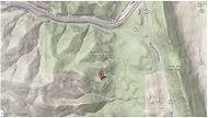
My Map 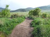
Begining of Red Rocks Trail 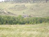
The Parking Lot at the Top of the Hill 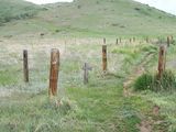
Small Graveyard in Front
Larger Graveyard in Back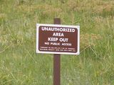
A Sign! 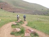
Warning, Bikers on Trail 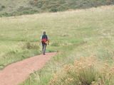
Bigger Warning, Park Ranger on Trail 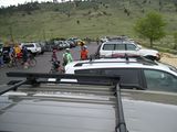
The Lot was Full!


