Difference between revisions of "2015-11-11 38 -84"
imported>CaptainSpam ([retro] So, I needed a good test hash point for the wiki feature in the revamped Geohash Droid (and to fix the broken feature in the existing version). And wouldn't you know it, one popped up a half mile from where I work! I'm a day late, sure, but i...) |
imported>FippeBot m (Location) |
||
| (5 intermediate revisions by 2 users not shown) | |||
| Line 13: | Line 13: | ||
| lon=-84 | | lon=-84 | ||
| date=2015-11-11 | | date=2015-11-11 | ||
| + | | retro=1 | ||
}} | }} | ||
| − | + | ||
__NOTOC__ | __NOTOC__ | ||
== Location == | == Location == | ||
| − | + | A small parking lot at the corner of Russel Cave and Park Place in Lexington, KY. | |
== Participants == | == Participants == | ||
| − | + | Just me, [[User:CaptainSpam|CaptainSpam]]. | |
| − | |||
== Plans == | == Plans == | ||
| − | + | The plan was simple: I needed to test a completely revamped version of Geohash Droid. In lieu of having to do field debugging in the wilds of central Kentucky, I decided to wait for something... easier. Less-dangerous, I should say. This hash has taught me that, in the near future, I will need a feature in my app to notify me if the hashpoint is near where I work/live/travel, as I realized it was there too late to go there on the day it actually happened. Thus, this became a retro hash. | |
== Expedition == | == Expedition == | ||
| − | |||
| − | |||
| − | |||
*So, I needed a good test hash point for the wiki feature in the revamped Geohash Droid (and to fix the broken feature in the existing version). And wouldn't you know it, one popped up a half mile from where I work! I'm a day late, sure, but it beats making a bogus expedition page and asking the admins to delete it later. Let's see if it works! -- [[User:CaptainSpam|CaptainSpam]] ([[User talk:CaptainSpam|talk]]) [http://www.openstreetmap.org/?lat=38.06855120&lon=-84.48165360&zoom=16&layers=B000FTF @38.0686,-84.4817] 15:01, 12 November 2015 (EST) | *So, I needed a good test hash point for the wiki feature in the revamped Geohash Droid (and to fix the broken feature in the existing version). And wouldn't you know it, one popped up a half mile from where I work! I'm a day late, sure, but it beats making a bogus expedition page and asking the admins to delete it later. Let's see if it works! -- [[User:CaptainSpam|CaptainSpam]] ([[User talk:CaptainSpam|talk]]) [http://www.openstreetmap.org/?lat=38.06855120&lon=-84.48165360&zoom=16&layers=B000FTF @38.0686,-84.4817] 15:01, 12 November 2015 (EST) | ||
| − | |||
| − | |||
== Photos == | == Photos == | ||
| − | |||
| − | |||
| − | |||
<gallery perrow="5"> | <gallery perrow="5"> | ||
| + | |||
| + | Image:2015-11-11_38_-84_CaptainSpam_1447358591320.jpg|The 455 Park Place building on the corner of Russell Cave and Park in Lexington, KY. Taken from the hash point. [http://www.openstreetmap.org/?lat=38.06853470&lon=-84.48164480&zoom=16&layers=B000FTF @38.0685,-84.4816] | ||
| + | |||
| + | Image:2015-11-11_38_-84_CaptainSpam_1447358675937.jpg|There's not much here, to be honest. An empty, lonely parking lot near a small business center I'm not sure anyone uses anymore. [http://www.openstreetmap.org/?lat=38.06853080&lon=-84.48163670&zoom=16&layers=B000FTF @38.0685,-84.4816] | ||
| + | |||
| + | Image:2015-11-11_38_-84_CaptainSpam_1447358732293.jpg|With any luck, I'll come back to my browser and see a well-formed wiki page with my pictures in it. With no luck, well, back to debugging... [http://www.openstreetmap.org/?lat=38.06852990&lon=-84.48163660&zoom=16&layers=B000FTF @38.0685,-84.4816] | ||
</gallery> | </gallery> | ||
| Line 47: | Line 45: | ||
<!-- Add any achievement ribbons you earned below, or remove this section --> | <!-- Add any achievement ribbons you earned below, or remove this section --> | ||
| − | |||
| − | |||
| − | |||
| − | |||
| − | |||
| − | |||
| − | |||
| − | |||
| − | |||
| − | |||
| − | |||
| − | |||
[[Category:Expeditions with photos]] | [[Category:Expeditions with photos]] | ||
| − | |||
| − | |||
| − | |||
| − | + | [[Category:Retro coordinates reached]] | |
| − | + | {{location|US|KY|FA}} | |
| − | |||
| − | |||
| − | |||
| − | [[Category: | ||
| − | |||
| − | |||
| − | |||
| − | |||
| − | |||
| − | |||
| − | |||
| − | |||
| − | |||
| − | |||
| − | |||
| − | |||
| − | |||
| − | |||
Latest revision as of 01:27, 7 August 2019
| Wed 11 Nov 2015 in 38,-84: 38.0685239, -84.4815802 geohashing.info google osm bing/os kml crox |
Location
A small parking lot at the corner of Russel Cave and Park Place in Lexington, KY.
Participants
Just me, CaptainSpam.
Plans
The plan was simple: I needed to test a completely revamped version of Geohash Droid. In lieu of having to do field debugging in the wilds of central Kentucky, I decided to wait for something... easier. Less-dangerous, I should say. This hash has taught me that, in the near future, I will need a feature in my app to notify me if the hashpoint is near where I work/live/travel, as I realized it was there too late to go there on the day it actually happened. Thus, this became a retro hash.
Expedition
- So, I needed a good test hash point for the wiki feature in the revamped Geohash Droid (and to fix the broken feature in the existing version). And wouldn't you know it, one popped up a half mile from where I work! I'm a day late, sure, but it beats making a bogus expedition page and asking the admins to delete it later. Let's see if it works! -- CaptainSpam (talk) @38.0686,-84.4817 15:01, 12 November 2015 (EST)
Photos
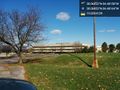
The 455 Park Place building on the corner of Russell Cave and Park in Lexington, KY. Taken from the hash point. @38.0685,-84.4816
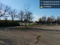
There's not much here, to be honest. An empty, lonely parking lot near a small business center I'm not sure anyone uses anymore. @38.0685,-84.4816
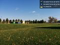
With any luck, I'll come back to my browser and see a well-formed wiki page with my pictures in it. With no luck, well, back to debugging... @38.0685,-84.4816


