Difference between revisions of "2008-05-31 43 -77"
imported>Cogit0 (added expedition categories) |
imported>Cogit0 (updated description of location.) |
||
| Line 14: | Line 14: | ||
[http://maps.google.com/maps?f=q&hl=en&geocode=&q=43.0374870832648067,+-77.2812664767643918&ie=UTF8&ll=43.042296,-77.300148&spn=0.096603,0.233459&z=12 Google Maps Link for 2008-05-31 43 -77]<BR> | [http://maps.google.com/maps?f=q&hl=en&geocode=&q=43.0374870832648067,+-77.2812664767643918&ie=UTF8&ll=43.042296,-77.300148&spn=0.096603,0.233459&z=12 Google Maps Link for 2008-05-31 43 -77]<BR> | ||
...which puts it south of Macedon near the end of a cul-de-sac.<BR> | ...which puts it south of Macedon near the end of a cul-de-sac.<BR> | ||
| − | |||
| − | |||
<br> | <br> | ||
Location reached - more details and pictures from home. --DavidF | Location reached - more details and pictures from home. --DavidF | ||
| + | <br><br> | ||
| + | The location was reached by 5 people. Since the actual site was on a "posted" (no trespassing) empty lot that was up for sale, only 3 people went out for the brief trek. En route to the location, we came upon a treehouse/deer lookout. When you find something like that, there is only one thing to do: climb it! | ||
| + | The group went out to a local diner for milkshakes and food afterwards. | ||
| − | |||
| − | + | ==Who Went== | |
| − | [[User:Cogit0|Mike]] | + | [[User:danierrr|danierrr]]<br> |
| − | + | [[User:Cogit0|Mike]]<br> | |
| − | [[User:DavidF|David]] | + | [[User:DavidF|David]]<br> |
| + | Ryan<br> | ||
| + | Dawn<br> | ||
==Plans== | ==Plans== | ||
| Line 35: | Line 37: | ||
==Pics (since it <i>did</i> happen)== | ==Pics (since it <i>did</i> happen)== | ||
| − | + | <gallery caption="Palmyra empty lot" widths="320px" heights="240px" perrow="2"> | |
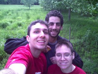
| − | + | Image:ROC-31May-1.jpg|Dan, Mike, & Dawn.<br> 2008-05-31 43 -77, Rochester, NY. | |
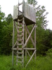
| − | + | Image:ROC-31May-2.jpg|The treehouse/deer lookout!<br> 2008-05-31 43 -77, Rochester, NY. | |
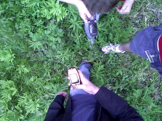
| − | + | Image:ROC-31May-3.jpg|Yup, that's the spot.<br> 2008-05-31 43 -77, Rochester, NY. | |
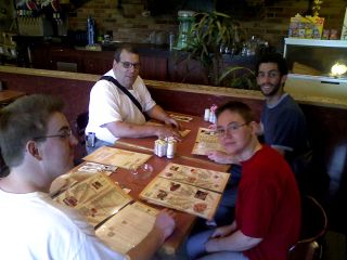
| + | Image:ROC-31May-4.jpg|Ryan, David, Dawn, Mike & Dan (taking pic) have milkshakes at a nearby diner.<br> 2008-05-31 43 -77, Rochester, NY. | ||
| + | </gallery> | ||
<BR> | <BR> | ||
All the pictures [[User:danierrr|danierrr]] took are on his Facebook (Daniel Rasheed), and distributed via e-mail :) | All the pictures [[User:danierrr|danierrr]] took are on his Facebook (Daniel Rasheed), and distributed via e-mail :) | ||
Revision as of 00:36, 2 June 2008
| Sat 31 May 2008 in 43,-77: 43.0374871, -77.2812665 geohashing.info google osm bing/os kml crox |
Location
It's reachable, and in Macedon/Palmyra, just ESE of Rochester.
Coordinates: (43.0374870832648067, -77.2812664767643918).
2008-05-31 43 -77 coordinates
also:
Google Maps Link for 2008-05-31 43 -77
...which puts it south of Macedon near the end of a cul-de-sac.
Location reached - more details and pictures from home. --DavidF
The location was reached by 5 people. Since the actual site was on a "posted" (no trespassing) empty lot that was up for sale, only 3 people went out for the brief trek. En route to the location, we came upon a treehouse/deer lookout. When you find something like that, there is only one thing to do: climb it!
The group went out to a local diner for milkshakes and food afterwards.
Who Went
Plans
- BRING GAMES!
- Anyone have a portable chess set or something? -Cogit0
- Anything around Macedon/Palmyra to do? Eastview Mall (*naive*)?
Pics (since it did happen)
- Palmyra empty lot
All the pictures danierrr took are on his Facebook (Daniel Rasheed), and distributed via e-mail :)


