Difference between revisions of "2016-05-01 34 -117"
From Geohashing
imported>AeroIllini (This pile of rocks marks the spot. [http://www.openstreetmap.org/?lat=34.75659530&lon=-117.15616460&zoom=16&layers=B000FTF @34.7566,-117.1562]) |
imported>AeroIllini (Some of the surrounding countryside. [http://www.openstreetmap.org/?lat=34.75659300&lon=-117.15616880&zoom=16&layers=B000FTF @34.7566,-117.1562]) |
||
| Line 43: | Line 43: | ||
Image:2016-05-01_34_-117_AeroIllini_1462113785123.jpg|This pile of rocks marks the spot. [http://www.openstreetmap.org/?lat=34.75659530&lon=-117.15616460&zoom=16&layers=B000FTF @34.7566,-117.1562] | Image:2016-05-01_34_-117_AeroIllini_1462113785123.jpg|This pile of rocks marks the spot. [http://www.openstreetmap.org/?lat=34.75659530&lon=-117.15616460&zoom=16&layers=B000FTF @34.7566,-117.1562] | ||
| + | |||
| + | Image:2016-05-01_34_-117_AeroIllini_1462113814782.jpg|Some of the surrounding countryside. [http://www.openstreetmap.org/?lat=34.75659300&lon=-117.15616880&zoom=16&layers=B000FTF @34.7566,-117.1562] | ||
</gallery> | </gallery> | ||
Revision as of 18:06, 1 May 2016
| Sun 1 May 2016 in 34,-117: 34.7565890, -117.1561773 geohashing.info google osm bing/os kml crox |
Location
Participants
Plans
Expedition
Tracklog
Photos

Success! @34.7566,-117.1562
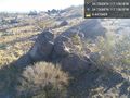
This pile of rocks marks the spot. @34.7566,-117.1562
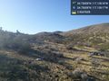
Some of the surrounding countryside. @34.7566,-117.1562


Achievements