Difference between revisions of "2018-02-02 51 13"
imported>Oisín (plan for 2018-02-02 51 13) |
imported>Danatar (Report! Danatar's pictures will follow) |
||
| Line 6: | Line 6: | ||
| graticule_link=Dresden, Germany | | graticule_link=Dresden, Germany | ||
}}__NOTOC__ | }}__NOTOC__ | ||
| − | |||
| − | |||
== Location == | == Location == | ||
| − | The hash is located in Dresden, Wiener Straße, a little south of the city center. The | + | The hash is located in Dresden, at the corner of Wiener Straße and Gret-Palucca-Straße, a little south of the city center. The spot is on the grass in front of an apartment building. |
| − | Country: Germany; state: Sachsen (Saxony, EU:DE:SN); municipality: Dresden | + | Country: Germany; state: Sachsen (Saxony, EU:DE:SN); municipality: Dresden; Ortsamt: Altstadt; Stadtteil: Seevorstadt-Ost/Großer Garten. |
| + | |||
| + | Weather: dry, sunny with some clouds | ||
| − | |||
== Participants == | == Participants == | ||
*[[User:Oisín|Oisín]] | *[[User:Oisín|Oisín]] | ||
| + | *[[User:Danatar|Danatar]] | ||
| + | |||
== Plans == | == Plans == | ||
*[[User:Oisín|Oisín]] plans to visit this hash in the afternoon, probably between 4 and 5 p.m. | *[[User:Oisín|Oisín]] plans to visit this hash in the afternoon, probably between 4 and 5 p.m. | ||
| + | * Danatar has to go there before work | ||
| + | |||
== Expedition == | == Expedition == | ||
| + | ===[[User:Danatar|Danatar]]=== | ||
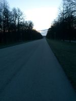
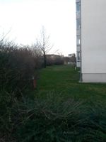
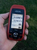
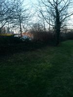
| + | The only opportunity for me to visit the hashpoint was before work, because after the regular work I was on on-call duty until the next day with no certainty to have time to visit the spot. So I accelerated my wake-up routine and started out by bike. I cycled through the ''Großer Garten'' park, then past the football stadium and the hygiene museum and after a short while I was near the spot. From the satellite image I already knew that it was on the grass in front of an apartment building but when I got there I could see that there was an additional hedge between the grass and the major road. So instead of walking 5 steps on the grass I had to go around the hedge, which didn't cover the side of the building. The GPS dance was short, with the spot right next to the hedge. I didn't stay long, just took some pictures and then went back to my bike. For cycling to work I used almost the same route until I was near home, then continued along Fetscherstraße until I was at work only a few minutes later than usual. | ||
| + | |||
| + | Most of the pictures are too dark because the exposure settings were still at "-2" from when I took pictures of a presentation at a seminar in Madrid, Spain, last week (there was no hashpoint nearby in the 1.5 days I was there). | ||
| + | {{gallery|width=200|height=200|lines=2 | ||
| + | |Image:2018-02-02_51_13_grossergarten.jpg|''Großer Garten'' park | ||
| + | |Image:2018-02-02_51_13_hygienemuseum.jpg|hygiene museum | ||
| + | |Image:2018-02-02_51_13_near.jpg|almost there | ||
| + | |Image:2018-02-02_51_13_gps.jpg|GPS | ||
| + | |Image:2018-02-02_51_13_spot.jpg|the hashpoint | ||
| + | |Image:2018-02-02_51_13_hp.jpg|coordinates reached! | ||
| + | }} | ||
| + | |||
| + | Tracklog: ''will follow'' | ||
| + | |||
| + | |||
| + | ===[[User:Oisín|Oisín]]=== | ||
| + | ... | ||
[[Category:Expedition planning]] | [[Category:Expedition planning]] | ||
Revision as of 07:56, 2 February 2018
| Fri 2 Feb 2018 in Dresden: 51.0389827, 13.7401296 geohashing.info google osm bing/os kml crox |
Location
The hash is located in Dresden, at the corner of Wiener Straße and Gret-Palucca-Straße, a little south of the city center. The spot is on the grass in front of an apartment building.
Country: Germany; state: Sachsen (Saxony, EU:DE:SN); municipality: Dresden; Ortsamt: Altstadt; Stadtteil: Seevorstadt-Ost/Großer Garten.
Weather: dry, sunny with some clouds
Participants
Plans
- Oisín plans to visit this hash in the afternoon, probably between 4 and 5 p.m.
- Danatar has to go there before work
Expedition
Danatar
The only opportunity for me to visit the hashpoint was before work, because after the regular work I was on on-call duty until the next day with no certainty to have time to visit the spot. So I accelerated my wake-up routine and started out by bike. I cycled through the Großer Garten park, then past the football stadium and the hygiene museum and after a short while I was near the spot. From the satellite image I already knew that it was on the grass in front of an apartment building but when I got there I could see that there was an additional hedge between the grass and the major road. So instead of walking 5 steps on the grass I had to go around the hedge, which didn't cover the side of the building. The GPS dance was short, with the spot right next to the hedge. I didn't stay long, just took some pictures and then went back to my bike. For cycling to work I used almost the same route until I was near home, then continued along Fetscherstraße until I was at work only a few minutes later than usual.
Most of the pictures are too dark because the exposure settings were still at "-2" from when I took pictures of a presentation at a seminar in Madrid, Spain, last week (there was no hashpoint nearby in the 1.5 days I was there).
|
Tracklog: will follow
Oisín
...
