Difference between revisions of "2019-04-09 51 8"
imported>GeorgDerReisende (expedition report for Frankenberg-Somplar) |
imported>Fippe m |
||
| Line 38: | Line 38: | ||
[[Category:Expedition without GPS]] | [[Category:Expedition without GPS]] | ||
| − | {{location|DE| | + | {{location|DE|HE|KB}} |
[[Category:Coordinates not reached]] | [[Category:Coordinates not reached]] | ||
[[Category:Not reached - Technology]] | [[Category:Not reached - Technology]] | ||
Latest revision as of 18:09, 10 April 2019
| Tue 9 Apr 2019 in 51,8: 51.0754999, 8.6919677 geohashing.info google osm bing/os kml crox |
Location
The hash lay at the side of the road from Somplar to Frankenberg.
Participants
Plans
Do the whole way by public transport, but I thought of some walking.
Expedition
I left home at 7 o'clock and took the train at 8:02 to Olsberg. There I took the bus S50 to Hallenberg. From Hallenberg to Bromskirchen I walked along an old railway track. In Bromskirchen I noticed that the bus from Bromskirchen to Somplar serves Hallenberg first. In Somplar I had to change to another bus and this one drove along the street with the hash at the side. Whitout the Garmin I was not able to see, if I was near the hash or not. So I thought that I had been a little bit too ambitious for this hash and named it a loss.
Photos
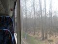
looks like at the hash, but some steps in the wood
opposite the street

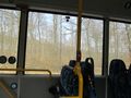
GeorgDerReisende in the bus
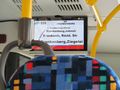
where this bus is going?


