Difference between revisions of "File:2012-10-19 32 -117 17-46-18-774.jpg"
From Geohashing
imported>LucasBrown ((LucasBrown) Map at the hashpoint [http://www.openstreetmap.org/?lat=32.96264266&lon=-117.25473757&zoom=16&layers=B000FTF @32.9626,-117.2547] Category:Meetup on 2012-10-19 Category:Meetup in 32 -117) |
(Maintenance script uploaded File:2012-10-19 32 -117 17-46-18-774.jpg) |
(No difference)
| |
Latest revision as of 14:48, 30 January 2020
(LucasBrown) Map at the hashpoint @32.9626,-117.2547
File history
Click on a date/time to view the file as it appeared at that time.
| Date/Time | Thumbnail | Dimensions | User | Comment | |
|---|---|---|---|---|---|
| current | 14:48, 30 January 2020 | 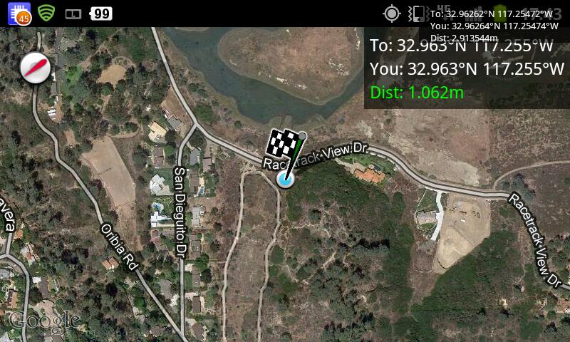 | 800 × 480 (101 KB) | Maintenance script (talk | contribs) |
- You cannot overwrite this file.
File usage
The following page links to this file: