Difference between revisions of "2008-06-05 42 -71"
From Geohashing
imported>Ben (Init.) |
imported>Ben |
||
| Line 1: | Line 1: | ||
| − | + | ==The Location== | |
| + | |||
| + | [http://irc.peeron.com/xkcd/map/map.html?date=2008-06-05&lat=42&long=-72&zoom=10&abs=1 Map Coordinates] | ||
| + | |||
| + | The site is located very near to the border between Foxborough, MA and Sharon, MA. It is several hundred meters from nearby Mansfield Street. The site falls on private property; specifically, the yard associated with a large house set back from Mansfield Street. A state park, Borderland State Park, is located close by. | ||
| + | |||
| + | ==The Geohash== | ||
| + | |||
| + | At roughly 3PM, [[User:Ben|Ben]] and Grace approached the site by car. We parked nearby and proceeded on foot. | ||
| + | |||
| + | <gallery caption="Pix, Because It Did Happen" widths="200px" heights="200px" perrow="3"> | ||
| + | Image:2008-06-05-42-71-01.jpg|The driveway from which the hash was accessible. | ||
| + | </gallery> | ||
| + | |||
| + | ==Post-Geohash Adventures== | ||
Revision as of 23:25, 5 June 2008
The Location
The site is located very near to the border between Foxborough, MA and Sharon, MA. It is several hundred meters from nearby Mansfield Street. The site falls on private property; specifically, the yard associated with a large house set back from Mansfield Street. A state park, Borderland State Park, is located close by.
The Geohash
At roughly 3PM, Ben and Grace approached the site by car. We parked nearby and proceeded on foot.
- Pix, Because It Did Happen
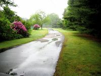
The driveway from which the hash was accessible.
