Difference between revisions of "2020-04-17 39 -78"
From Geohashing
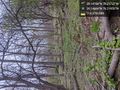
([live picture]Navigation is incredibly difficult here because I believe that GPS is malfunctioning due to some geographical features [https://openstreetmap.org/?lat=39.14683790&lon=-78.21950450&zoom=16&layers=B000FTF @39.1468,-78.2195]) |
([live picture]Feels farther, but the app says I'm closer. And it's starting to rain [https://openstreetmap.org/?lat=39.14861930&lon=-78.21751970&zoom=16&layers=B000FTF @39.1486,-78.2175]) |
||
| Line 36: | Line 36: | ||
Image:2020-04-17_39_-78_OfficeLinebacker_1587164255143.jpg|Navigation is incredibly difficult here because I believe that GPS is malfunctioning due to some geographical features [https://openstreetmap.org/?lat=39.14683790&lon=-78.21950450&zoom=16&layers=B000FTF @39.1468,-78.2195] | Image:2020-04-17_39_-78_OfficeLinebacker_1587164255143.jpg|Navigation is incredibly difficult here because I believe that GPS is malfunctioning due to some geographical features [https://openstreetmap.org/?lat=39.14683790&lon=-78.21950450&zoom=16&layers=B000FTF @39.1468,-78.2195] | ||
| + | |||
| + | Image:2020-04-17_39_-78_OfficeLinebacker_1587164851016.jpg|Feels farther, but the app says I'm closer. And it's starting to rain [https://openstreetmap.org/?lat=39.14861930&lon=-78.21751970&zoom=16&layers=B000FTF @39.1486,-78.2175] | ||
</gallery> | </gallery> | ||
Revision as of 23:07, 17 April 2020
| Fri 17 Apr 2020 in 39,-78: 39.1478786, -78.2173695 geohashing.info google osm bing/os kml crox |
Location
Participants
Plans
Expedition
Tracklog
Photos
Navigation is incredibly difficult here because I believe that GPS is malfunctioning due to some geographical features @39.1468,-78.2195

Feels farther, but the app says I'm closer. And it's starting to rain @39.1486,-78.2175


Achievements