Difference between revisions of "2013-11-02 35 -118"
From Geohashing
imported>Captnemo42 (→Achievements) |
m |
||
| (13 intermediate revisions by 2 users not shown) | |||
| Line 1: | Line 1: | ||
{{meetup graticule | {{meetup graticule | ||
| − | | lat= | + | | lat=35 |
| − | | lon=- | + | | lon=-118 |
| − | | date= | + | | date=2013-11-02 |
}} | }} | ||
== Location == | == Location == | ||
| + | Meetup location: | ||
| + | * 35.742574°, -118.721948° or | ||
| + | * N35°44.5544', W118°43.3168' or | ||
| + | * N35°44'33.26", W118°43'19.01" | ||
| − | + | I'm heading out to try and reach the coordinates by 4pm today, Saturday 11/2, if anyone cares to try and meet me- looks like it may be acessible as its only 300' from a road. | |
== Participants == | == Participants == | ||
| − | + | [[User:captnemo42|captnemo42]] | |
| − | [[User: | ||
== Plans == | == Plans == | ||
| − | + | Meetup location: | |
| + | * 35.742574°, -118.721948° or | ||
| + | * N35°44.5544', W118°43.3168' or | ||
| + | * N35°44'33.26", W118°43'19.01" | ||
== Expedition == | == Expedition == | ||
| − | |||
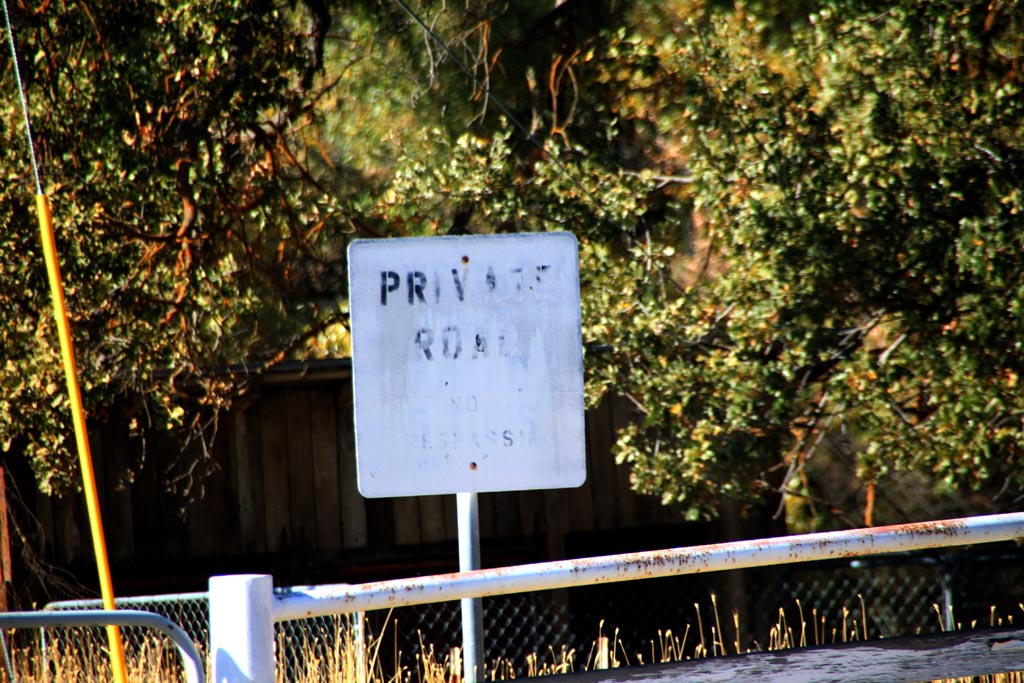
| − | == | + | *On private road/ property:( -- [[User:Captnemo42|Captnemo42]] ([[User talk:Captnemo42|talk]]) [http://www.openstreetmap.org/?lat=35.69317221&lon=-119.06546924&zoom=16&layers=B000FTF @35.6932,-119.0655] 15:49, 2 November 2013 (PDT) |
| − | + | gate was locked. | |
| − | == | + | == Tracklog == |
| − | + | == Photos == | |
| − | + | [[File:Private propertyIMG 0010.jpg]] | |
| − | |||
== Achievements == | == Achievements == | ||
| − | |||
| − | |||
| − | |||
| − | |||
| − | |||
| − | |||
| − | |||
| − | |||
| − | |||
| − | |||
[[Category:Expeditions]] | [[Category:Expeditions]] | ||
[[Category:Expeditions with photos]] | [[Category:Expeditions with photos]] | ||
[[Category:Coordinates not reached]] | [[Category:Coordinates not reached]] | ||
| − | [[Category:Not reached - | + | [[Category:Not reached - No public access]] |
| + | {{location|US|CA|KE}} | ||
Latest revision as of 13:16, 22 September 2021
| Sat 2 Nov 2013 in 35,-118: 35.7425747, -118.7219477 geohashing.info google osm bing/os kml crox |
Location
Meetup location:
- 35.742574°, -118.721948° or
- N35°44.5544', W118°43.3168' or
- N35°44'33.26", W118°43'19.01"
I'm heading out to try and reach the coordinates by 4pm today, Saturday 11/2, if anyone cares to try and meet me- looks like it may be acessible as its only 300' from a road.
Participants
Plans
Meetup location:
- 35.742574°, -118.721948° or
- N35°44.5544', W118°43.3168' or
- N35°44'33.26", W118°43'19.01"
Expedition
- On private road/ property:( -- Captnemo42 (talk) @35.6932,-119.0655 15:49, 2 November 2013 (PDT)
gate was locked.
