Difference between revisions of "2009-03-03 29 -81"
(New page: {{meetup graticule | map=<map lat="29" lon="-81" date="2009-03-03" /> | lat=29 | lon=-81 | date=2009-03-03 | graticule_name=Daytona Beach, Florida | graticule_link=Daytona Beach, Florida}}...) |
m |
||
| (4 intermediate revisions by 4 users not shown) | |||
| Line 21: | Line 21: | ||
<gallery caption="Photo Gallery" widths="200px" heights="200px" perrow="3"> | <gallery caption="Photo Gallery" widths="200px" heights="200px" perrow="3"> | ||
| − | + | Image:2009-03-03 29 -81 Springbank.jpg|Springbank Road. | |
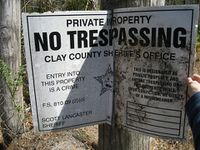
| + | Image:2009-03-03 29 -81 No Tres.jpg | ||
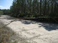
| + | Image:2009-03-03 29 -81 3 locks.jpg|They were serious. | ||
| + | Image:2009-03-03 29 -81 Nick and z.jpg|Stupid grin. | ||
| + | Image:2009-03-03 29 -81 GPS.jpg|So close, yet so far. | ||
| + | Image:2009-03-03 29 -81 down road.jpg|Down the road. | ||
| + | Image:2009-03-03 29 -81 downtown green cove.jpg|Green Cove Springs, FL | ||
| + | Image:2009-03-03 29 -81 Caboose.jpg|A caboose in the historic district. | ||
| + | Image:2009-03-03 29 -81 city hall.jpg|City Hall. | ||
| + | |||
| + | |||
</gallery> | </gallery> | ||
| − | {{No trespassing | + | {{No trespassing |
| latitude = 29 | | latitude = 29 | ||
| longitude = -81 | | longitude = -81 | ||
| Line 33: | Line 43: | ||
[[Category:Expeditions]] | [[Category:Expeditions]] | ||
[[Category:Coordinates not reached]] | [[Category:Coordinates not reached]] | ||
| − | [[Category:No | + | [[Category:Not reached - No public access]] |
| + | {{location|US|FL|CY}} | ||
Latest revision as of 10:19, 16 March 2022
| Tue 3 Mar 2009 in Daytona Beach, Florida: 29.8932854, -81.7547157 geohashing.info google osm bing/os kml crox |
Expeditions
Geohashers in Attendance
The Drive
The hash point was located a bit south of Green Cove Springs, FL. I left for the hash with a vague idea of where I was going. I had my trusty iPhone to give me directions. On the way down, I had the pleasure of driving on Springbank Rd. Springbank is a lonely road connecting nowhere to nowhere. I didn't see another car the whole time I was on it. About 5 miles from SR 16 I found Dan Moody Rd. About 100 yards after the turn there was a gate with not one, not two, but three locks keeping it shut. There were also signs from the Clay Country Sheriffs Office telling people to keep off the land. I obeyed their broken signs, took some pictures, and went on my way with a no trespassing.
Gallery
- Photo Gallery
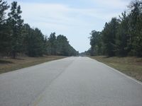
Springbank Road.
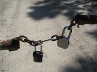
They were serious.
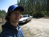
Stupid grin.
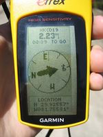
So close, yet so far.
Down the road.
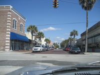
Green Cove Springs, FL
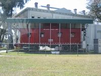
A caboose in the historic district.
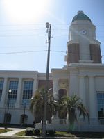
City Hall.


Woodveil earned the No trespassing consolation prize
|