Difference between revisions of "2011-12-25 33 -84"
From Geohashing
imported>NWoodruff (Created page with "{{meetup graticule | map=<map lat="33" lon="-84" date="2011-12-25" /> | lat=33 | lon=-84 | date=2011-12-25 | graticule_name=Atlanta | graticule_link=Atlanta, Georgia }} == Grat...") |
m |
||
| (3 intermediate revisions by 3 users not shown) | |||
| Line 23: | Line 23: | ||
== Gallery == | == Gallery == | ||
<gallery perrow="3"> | <gallery perrow="3"> | ||
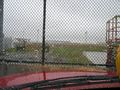
| − | Image:2011122533-84NW01.JPG </gallery> | + | Image:2011122533-84NW01.JPG | 0.30 of a mile to go. As close as I could get. |
| + | Image:2011122533-84NW02.JPG | Time of the meetup. | ||
| + | Image:2011122533-84NW03.JPG | Date of the meetup. | ||
| + | Image:2011122533-84NW04.JPG | 11 Feet accuracy. | ||
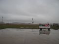
| + | Image:2011122533-84NW05.JPG | The Geohash point is out there in the middle of the tarmacs. I don't suggest trying to make it. | ||
| + | Image:2011122533-84NW06.JPG | No Trespassing. | ||
| + | Image:2011122533-84NW07.JPG | Honorary Geohashers. | ||
| + | Image:2011122533-84NW08.JPG | The takeoff tarmac is farther away than the landing tarmac. This plane probably qualifies for a did not reach. | ||
| + | </gallery> | ||
== Achievements == | == Achievements == | ||
| Line 30: | Line 38: | ||
[[Category:Expeditions with photos]] | [[Category:Expeditions with photos]] | ||
[[Category:Coordinates not reached]] | [[Category:Coordinates not reached]] | ||
| + | [[Category:Not reached - No public access]] | ||
| + | {{location|US|GA|CN}} | ||
Latest revision as of 11:37, 22 April 2022
| Sun 25 Dec 2011 in Atlanta: 33.6484867, -84.4186861 geohashing.info google osm bing/os kml crox |
Graticule
About
In the center island of the North runway tarmac of Hartsfield-Jackson Atlanta Airport.
Expedition
NWoodruff
Gallery
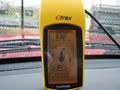
0.30 of a mile to go. As close as I could get.
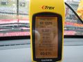
Time of the meetup.
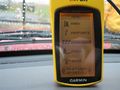
Date of the meetup.
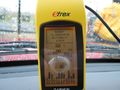
11 Feet accuracy.
The Geohash point is out there in the middle of the tarmacs. I don't suggest trying to make it.
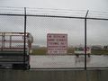
No Trespassing.
Honorary Geohashers.
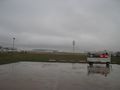
The takeoff tarmac is farther away than the landing tarmac. This plane probably qualifies for a did not reach.


