Difference between revisions of "2009-10-18 33 -84"
imported>NWoodruff (New page: {{meetup graticule | map=<map lat="33" lon="-84" date="2009-10-18" /> | lat=33 | lon=-84 | date=2009-10-18 | graticule_name=Atlanta | graticule_link=Atlanta, Georgia }} == Graticule == ...) |
m |
||
| (5 intermediate revisions by 2 users not shown) | |||
| Line 20: | Line 20: | ||
=== [[User:NWoodruff|NWoodruff]] === | === [[User:NWoodruff|NWoodruff]] === | ||
| − | I drove out to his hash point and followed Google directions. the last turn on to the dirt road has a big fence in front of it. There are | + | I drove out to his hash point and followed Google directions. the last turn on to the dirt road has a big gated fence in front of it. There are many signs posted for no trespassing. I hopped out and took a few pictures. 0.30 of a mile is as close as I could get. |
| + | I drove down the road for a little bit because I saw on the map that there is another dirt road that leads to the hash spot. I found the road and started to drive down it. I came up on another "Authorized vehicles" sign. I kept driving. I then came up on the big gate fence. The gate was open. But, with the number of "No Trespassing" signs that were posted on it, I decided that I was not going to get to the hash point. I hopped out and took a few picture. | ||
| + | |||
| + | I then called it a day and drove back to Norcross. | ||
== Gallery == | == Gallery == | ||
<gallery caption="Photo Gallery" widths="200px" heights="200px" perrow="3"> | <gallery caption="Photo Gallery" widths="200px" heights="200px" perrow="3"> | ||
| − | Image:2009101833-84NW01.JPG| | + | Image:2009101833-84NW01.JPG| 0.3 miles to go. Not close enough. |
| + | Image:2009101833-84NW02.JPG| Time of the almost meetup. | ||
| + | Image:2009101833-84NW03.JPG| Date of the almost meetup. | ||
| + | Image:2009101833-84NW04.JPG| The reason for the almost meetup, the dreaded "No Trespassing" sign. | ||
| + | Image:2009101833-84NW05.JPG| So close, yet so far away. The hash point is down there somewhere. | ||
| + | Image:2009101833-84NW06.JPG| Authorized vehicles only... | ||
| + | Image:2009101833-84NW07.JPG| There is another road that leads down to the hash point. | ||
| + | Image:2009101833-84NW08.JPG| The other road that I wanted to take a look down. | ||
| + | Image:2009101833-84NW09.JPG| The dreaded authorized vehicles only. But there is no gate or anything. | ||
| + | Image:2009101833-84NW11.JPG| This looks promising. | ||
| + | Image:2009101833-84NW12.JPG| Well, except there is a gate here with another "No Trespassing" sign. The gate is open and I bet there isn't a soul around for miles. | ||
| + | Image:2009101833-84NW13.JPG| The open gate. | ||
| + | Image:2009101833-84NW14.JPG| The multiple locks were all unlocked, not broken open. | ||
| + | Image:2009101833-84NW15.JPG| 2.31 miles to go. Not close enough. | ||
| + | Image:2009101833-84NW16.JPG| The time of when I gave up on trying to reach the Geohash spot. | ||
</gallery> | </gallery> | ||
| Line 32: | Line 49: | ||
[[Category:Expeditions]] | [[Category:Expeditions]] | ||
[[Category:Coordinates not reached]] | [[Category:Coordinates not reached]] | ||
| + | [[Category:Not reached - No public access]] | ||
[[Category:Expeditions with photos]] | [[Category:Expeditions with photos]] | ||
| + | {{location|US|GA|CN}} | ||
Latest revision as of 09:29, 25 April 2022
| Sun 18 Oct 2009 in Atlanta: 33.4945374, -84.2894258 geohashing.info google osm bing/os kml crox |
Graticule
About
On a big open field on Clayton County public water property.
Expedition
NWoodruff
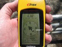
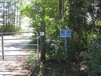
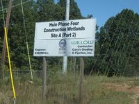
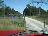
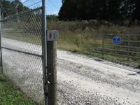
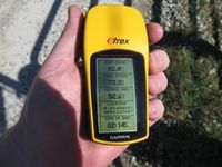
I drove out to his hash point and followed Google directions. the last turn on to the dirt road has a big gated fence in front of it. There are many signs posted for no trespassing. I hopped out and took a few pictures. 0.30 of a mile is as close as I could get.
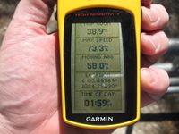
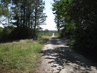
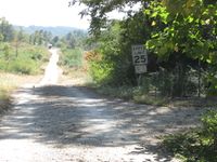
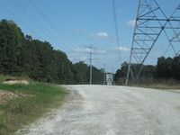
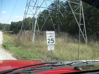
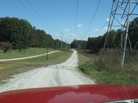
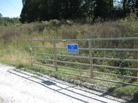
I drove down the road for a little bit because I saw on the map that there is another dirt road that leads to the hash spot. I found the road and started to drive down it. I came up on another "Authorized vehicles" sign. I kept driving. I then came up on the big gate fence. The gate was open. But, with the number of "No Trespassing" signs that were posted on it, I decided that I was not going to get to the hash point. I hopped out and took a few picture.
I then called it a day and drove back to Norcross.
Gallery
- Photo Gallery
