Difference between revisions of "Mansfield, Ohio"
imported>Moose Hole m (Updated neighbors) |
m (per Renaming Proposal) |
||
| (30 intermediate revisions by 15 users not shown) | |||
| Line 1: | Line 1: | ||
{{graticule | {{graticule | ||
| − | | | + | | lat= 40 |
| − | |n = [[Sandusky, Ohio]] | + | | lon= -82 |
| − | |ne = [[Cleveland, Ohio]] | + | | nw = [[Toledo, Ohio|Toledo]] |
| − | | | + | | n = [[Sandusky, Ohio|Sandusky]] |
| − | | | + | | ne = [[Cleveland, Ohio|Cleveland]] |
| − | | | + | | w = [[Marysville, Ohio|Marysville]] |
| − | |sw = [[Wilmington, Ohio|Wilmington]] | + | | name = [[Mansfield, Ohio|Mansfield]] |
| − | |s = [[Lancaster, Ohio|Lancaster]] | + | | e = [[Canton, Ohio|Canton]] |
| − | |se = [[Marietta, Ohio|Marietta]] | + | | sw = [[Wilmington, Ohio|Wilmington]] |
| + | | s = [[Lancaster, Ohio|Lancaster]] | ||
| + | | se = [[Marietta, Ohio|Marietta]] | ||
}} | }} | ||
'''Today's Location:''' | '''Today's Location:''' | ||
| − | + | {{Today's location|lat=40|lon=-82|text=Mansfield (40,-82)}} | |
The Mansfield graticule is at (40, -82). The graticule is almost completely rural, created high odds the geohash will be in a nice field somewhere. Also contained are such scenic areas as the Mohican and Alum Creek state parks. Major cities include the northeast portion of [[Columbus, Ohio]] (which is split almost exactly at its center into four graticules), Mansfield, Ashland, Bucyrus, and Mt. Vernon. | The Mansfield graticule is at (40, -82). The graticule is almost completely rural, created high odds the geohash will be in a nice field somewhere. Also contained are such scenic areas as the Mohican and Alum Creek state parks. Major cities include the northeast portion of [[Columbus, Ohio]] (which is split almost exactly at its center into four graticules), Mansfield, Ashland, Bucyrus, and Mt. Vernon. | ||
| Line 18: | Line 20: | ||
== Activities == | == Activities == | ||
| − | + | *[[2008-05-23 40 -82]]: Rattail, Sandy, and Butters made an expedition to the point. | |
| − | + | *[[2008-05-24 40 -82]]: Rattail made it there around 4:30-4:45 and nobody was there...so he took a picture and left. | |
| − | + | *[[2008-05-26 40 -82]]: Ernest arrived at 6:15 AM local time on the 27th. Today this would be considered a retro expedition, but this was within the 1st week after the algorithm was published. | |
| − | + | *[[2008-05-27 40 -82]]: Sandy, Ashley, and Rattail visited the coordinates. | |
| − | [[ | + | *[[2008-05-28 40 -82]]: Rattail and Sammi visited the hash. |
| + | *[[2008-06-29 40 -82]]: Chris, Alex, and their tagalong friend Grace made it to the hash near Bellville, Ohio. | ||
| + | *[[2008-07-05 40 -82]]: Chris, Alex, and Susan went to the hash, which was in a Kroger parking lot in Westerville, east of Polaris. | ||
| + | *[[2008-07-19 40 -82]]: The hash was down in Westerville, Ohio, near the Hoover Reservoir. | ||
| + | *[[2009-08-12 40 -82]]: Ernest tried biking to the hash, but it was on private property. | ||
| + | *[[2011-10-28 40 -82]]: [[User:Jschleappi]] attempted to reach the hash, but it was on private property. | ||
== Notable Events == | == Notable Events == | ||
1. [[User:GnEeErKd|Rattail]], Sandy, and Butters made the [[2008-05-23 40 -82|first]] documented geohash in this graticule on May 23, 2008. | 1. [[User:GnEeErKd|Rattail]], Sandy, and Butters made the [[2008-05-23 40 -82|first]] documented geohash in this graticule on May 23, 2008. | ||
| − | + | {{Graticule unlocked | latitude = 40 | longitude = -82 | date = 2008-05-23 | name = [[User:GnEeErKd|Rattail]], Sandy, and Butters | image = Hash.jpg }} | |
2. [[User:GnEeErKd|Rattail]] and Sammi went to the Saturday meeting geohash but were half an hour late and nobody was there on May 24, 2008. | 2. [[User:GnEeErKd|Rattail]] and Sammi went to the Saturday meeting geohash but were half an hour late and nobody was there on May 24, 2008. | ||
| Line 37: | Line 44: | ||
== Local Geohashers == | == Local Geohashers == | ||
| − | * [[User:Tytrain|Ernest]] | + | * [[User:Tytrain|Ernest]] is in school, and sadly no longer resides in this graticule. |
* Delirium might make an effort to go to one or two, seeing as she's at the exact corner of this and another (hereby inactive) graticule. | * Delirium might make an effort to go to one or two, seeing as she's at the exact corner of this and another (hereby inactive) graticule. | ||
| Line 48: | Line 55: | ||
[[Category:Ohio]] | [[Category:Ohio]] | ||
| − | [[Category: | + | [[Category:Inactive graticules]] |
| + | [[Category:Unlocked graticules]] | ||
Latest revision as of 07:04, 20 March 2024
| Toledo | Sandusky | Cleveland |
| Marysville | Mansfield | Canton |
| Wilmington | Lancaster | Marietta |
|
Today's location: geohashing.info google osm bing/os kml crox | ||
Today's Location: Mansfield (40,-82)
The Mansfield graticule is at (40, -82). The graticule is almost completely rural, created high odds the geohash will be in a nice field somewhere. Also contained are such scenic areas as the Mohican and Alum Creek state parks. Major cities include the northeast portion of Columbus, Ohio (which is split almost exactly at its center into four graticules), Mansfield, Ashland, Bucyrus, and Mt. Vernon.
Activities
- 2008-05-23 40 -82: Rattail, Sandy, and Butters made an expedition to the point.
- 2008-05-24 40 -82: Rattail made it there around 4:30-4:45 and nobody was there...so he took a picture and left.
- 2008-05-26 40 -82: Ernest arrived at 6:15 AM local time on the 27th. Today this would be considered a retro expedition, but this was within the 1st week after the algorithm was published.
- 2008-05-27 40 -82: Sandy, Ashley, and Rattail visited the coordinates.
- 2008-05-28 40 -82: Rattail and Sammi visited the hash.
- 2008-06-29 40 -82: Chris, Alex, and their tagalong friend Grace made it to the hash near Bellville, Ohio.
- 2008-07-05 40 -82: Chris, Alex, and Susan went to the hash, which was in a Kroger parking lot in Westerville, east of Polaris.
- 2008-07-19 40 -82: The hash was down in Westerville, Ohio, near the Hoover Reservoir.
- 2009-08-12 40 -82: Ernest tried biking to the hash, but it was on private property.
- 2011-10-28 40 -82: User:Jschleappi attempted to reach the hash, but it was on private property.
Notable Events
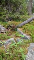
1. Rattail, Sandy, and Butters made the first documented geohash in this graticule on May 23, 2008.
Rattail, Sandy, and Butters earned the Graticule Unlocked Achievement
|
2. Rattail and Sammi went to the Saturday meeting geohash but were half an hour late and nobody was there on May 24, 2008.
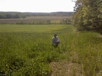
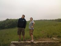
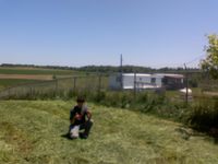
- Pictures
(May 23) Sandy and Butters are pictured, Rattail is taking the picture.
(May 24) Rattail is pictured, Sammi is taking the picture.
(May 27) Sandy and Ashley are pictured, Rattail is taking the picture.
(May 28) Rattail is pictured, Sammi is taking the picture. This one is fairly blurry but we were in a hurry so I left it.
Local Geohashers
- Ernest is in school, and sadly no longer resides in this graticule.
- Delirium might make an effort to go to one or two, seeing as she's at the exact corner of this and another (hereby inactive) graticule.
- Aaronbeekay will probably tag along with Delirium because he's a sucker for women.
- Rattail and friends will try to hit the nearby ones when possible, especially the Saturday meets.


