Difference between revisions of "2024-08-31 48 11"
From Geohashing
(→Photos) |
|||
| Line 23: | Line 23: | ||
File:2024-08-31 48 11 week gps proof.png | week gps proof | File:2024-08-31 48 11 week gps proof.png | week gps proof | ||
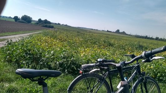
File:2024-08-31 48 11 bicycle proof.jpeg | bicycle proof | File:2024-08-31 48 11 bicycle proof.jpeg | bicycle proof | ||
| − | File:2024-08-31 48 11 distance.jpeg | | + | File:2024-08-31 48 11 distance.jpeg | wrong distance |
File:2024-08-31 48 11 location.jpeg | view of the hash from the farm track | File:2024-08-31 48 11 location.jpeg | view of the hash from the farm track | ||
</gallery> | </gallery> | ||
Revision as of 15:38, 20 September 2024
| Sat 31 Aug 2024 in 48,11: 48.3466976, 11.4455111 geohashing.info google osm bing/os kml crox |
Location
In Röhrmoos next to the train line
Participants
- Iqui
- my mother
Plans
- Iqui: I'll be there before 13:00, hopefully the hash is accessible
Expedition
- Iqui: We got up early in the morning (around 8:00), so we wouldn't have to face the heat of the noon. I knew the way very well already, as the hash was located near a cycle path that I regularly take. Sadly, the exact spot was on a pea field, around 15m away from us and the farm track, so we couldn't get it. I can only proof that with the picture of the field though because I forgot to get the gps proof and therefore only have this zoomed out version that doesn't proof anything :]!
(We rode 35,16km overall, but the tachometer only shows 29,58, because I forgot to put it on my bike and realised it too late)
Photos

week gps proof
bicycle proof
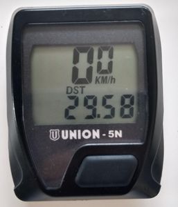
wrong distance
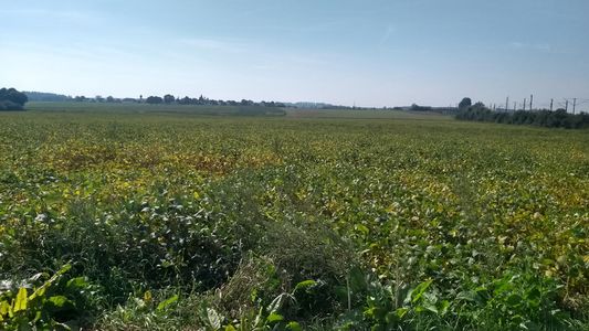
view of the hash from the farm track


