Difference between revisions of "2008-10-22 -19 146"
From Geohashing
imported>Randomibis |
m |
||
| (9 intermediate revisions by 6 users not shown) | |||
| Line 1: | Line 1: | ||
| − | {{No trespassing | + | {{meetup graticule|lat=-19|lon=146|date=2008-10-22}} |
| + | {{No trespassing|latitude=-19|longitude=146|date=2008-10-22|name=[[User:Randomibis|Randomibis]]|image=Photo-732508.jpg}} | ||
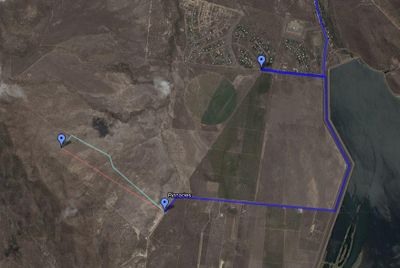
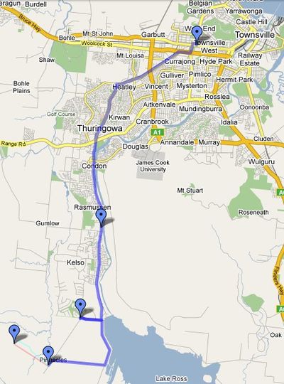
* [http://maps.google.com/maps/ms?ie=UTF&msa=0&msid=103463249426654549541.000459e1257f3bb81b5ba An annotated Google Map of the route taken] | * [http://maps.google.com/maps/ms?ie=UTF&msa=0&msid=103463249426654549541.000459e1257f3bb81b5ba An annotated Google Map of the route taken] | ||
* [http://glosoli.blogspot.com/2008/10/fail-point-two.html A brief description of the attempt]. | * [http://glosoli.blogspot.com/2008/10/fail-point-two.html A brief description of the attempt]. | ||
| − | * | + | * One more trip photo [http://glosoli.blogspot.com/2008/10/post-fail-refuel.html here] |
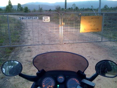
[[Image:Photo-732508.jpg|left|thumb|400px|'Trespassers Prosecuted' and padlock]] | [[Image:Photo-732508.jpg|left|thumb|400px|'Trespassers Prosecuted' and padlock]] | ||
| + | <br> | ||
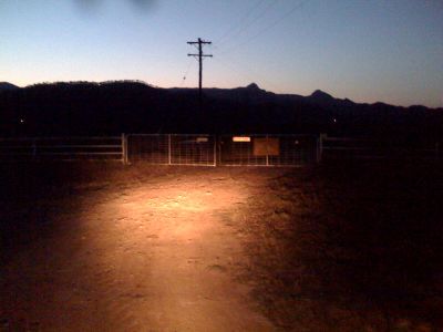
| + | [[Image:Photo-749879.jpg|left|thumb|400px|And again. This is the closest point reached]] | ||
| + | <br> | ||
| + | [[Image:Map2.jpg|left|thumb|400px]] | ||
| + | <br> | ||
| + | [[Image:Map1.jpg|left|thumb|400px]] | ||
[[Category:Meetup in -19 146]] | [[Category:Meetup in -19 146]] | ||
| + | [[Category:Expeditions]] | ||
| + | [[Category:Expeditions with photos]] | ||
| + | [[Category:Coordinates not reached]] | ||
| + | [[Category:Not reached - No public access]] | ||
| + | {{location|AU|QLD|TV}} | ||
Latest revision as of 17:01, 19 March 2022
| Wed 22 Oct 2008 in -19,146: -19.4256092, 146.6821185 geohashing.info google osm bing/os kml crox |
Randomibis earned the No trespassing consolation prize
|
- An annotated Google Map of the route taken
- A brief description of the attempt.
- One more trip photo here


